December 31, 2016

Utahns aim to ‘Trump’ Bears Ears monument designation

Protesters demonstrate against the new Bears Ear National Monument in San Juan County. President Barack Obama expanded his environmental legacy in the final days of his presidency with national monument designations on lands in Utah and Nevada that have become flashpoints over use of public land in the U.S. West, Montecello, Utah, Dec. 29, 2016 | Photo by Rick Egan/The Salt Lake Tribune via AP, St. George News

Written by Mori Kessler
St. George News


ST. GEORGE – In the wake of President Barrack Obama’s designating the Bears Ears National Monument Wednesday, Utah officials have vowed to use every means open to them to see the new monument undone. They are also looking to the next resident of the White House as a hopeful ally in this endeavor.

During a gathering held Thursday in San Juan County protesting the new monument, many signs with the phrase “Trump this Monument” were displayed and held high. Speakers at the event also repeated the phrase as they appealed to President-elect Donald Trump to aid in dismantling the unwanted monument.

Views differ on whether or not Trump can actually undo the creation of the monument once in office.

Christy Goldfuss, managing director of the White House Council on Environmental Quality, said the Antiquities Act that allows a president to create monuments does not give a president authority to undo a designation, a rule the courts have upheld. She acknowledged, though, that Congress could take action.

The Antiquities Act of 1906 authorizes the president “to declare by public proclamation historic landmarks, historic and prehistoric structures, and other objects of historic or scientific interest that are situated upon the lands owned or controlled by the Government of the United States to be national monuments.”

The Act was approved by Congress and used by then President Theodore Roosevelt to create the Devil’s Tower National Monument in Wyoming in 1906.

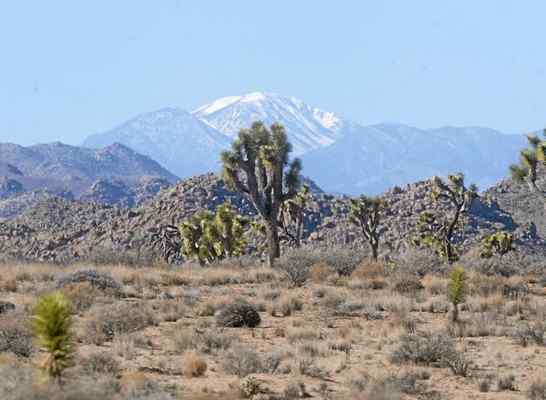
In Obama’s statement regarding the creation of the 1.35 million acre Bears Ears National Monument, the president said it is “to protect some of our country’s most important cultural treasures, including abundant rock art, archaeological sites, and lands considered sacred by Native American tribes.”

Read more: Utah Republicans bristle at Bears Ears National Monument designation

As reported by the Deseret News, Goldfuss told reporters the Obama administration isn’t worried about the backlash out of Utah and believes attempts to undo the new monument will be unsuccessful.

However, Conn Carroll, communications director for Sen. Mike Lee, told St. George News Thursday: “What has been done by executive power can be undone by executive power.”

While the Act may not expressly allow a president to simply undo a monument designation, it does empower the president the ability to make “modifications,” Carroll said.

“There’s nothing in the act that mandates or controls how much (a monument) can be changed,” he said.

If Trump wanted to, Carroll said, he could change the size of the Bear Ears Monument and shrink it considerably. Once done, Congress could come in and pass Bishop’s Public Lands Initiative which would protect part of Bears Ears as a national conservation area while opening other parts to local and economic development.

“That would functionally undo 99.9 percent of what Obama did,” Carroll said.

Taking this route is a potential way Lee and other Utah delegates hope to work with the incoming administration to undo the national monument.

“We’re optimistic that the Trump administration will do the right thing and honor the wishes of the people of Utah,” Carroll said. “This monument is on sand. It’s very precarious and we should be optimistic it can be functionally undone.”

Other avenues Utah’s leaders and congressional delegation are likely to pursue moving forward include possible legislation and litigation.

Stewart has stated that he will use his position on the House Appropriations Committee to block funding to the new monument.

Sen. Orrin Hatch said Wednesday that he will meet with Rep. Ryan Zinke, R-Montana, Trump’s nominee for interior secretary, and discuss what may be done about reversing the monument designation.

“His responses will largely determine my support for his confirmation,” Hatch said.

In addition, Hatch and Lee will reintroduce legislation to make Utah exempt from future presidents’ use of the Antiquities Act to designate monuments. It would be similar to legislation passed in 1950 exempting Wyoming from the Antiquities Act and place the creation of any new monument in the hands of Congress.

There has also been talk among the congressional delegation of either seeking to repeal the Antiques Act or greatly restricting its use in the future.

On Thursday, Chaffetz, who chairs the House Committee on Oversight and Government Reform, sent subpoenas to Interior Secretary Sally Jewell and Goldfuss demanding a document dump related to the Bears Ear National Monument designation going back to 2013.

In the letters, Chaffetz states concerns that the Obama administration stepped over federal procedures involving local stakeholders and proper environmental assessment.

“(Obama’s) sweeping application of the Antiquities Act raises questions about the administration’s commitment to transparency and consultation with local stakeholders with respect to designating national monuments,” Chaffetz wrote.

He continued: “… The (National Environmental Policy Act) and (Federal Land Policy Management Act) processes provide for a more thoughtful determination, whereas the Antiquities Act was meant to be reserved for emergency scenarios.”

Previous attempts by the Oversight Committee to obtain information regarding the Obama administration’s process for using the Antiquities Act have thus far met with a limited response, Chaffetz wrote.

Jewell and Goldfuss have till Jan. 13, 2017, to produce the requested documents. Failure to do so will result in the committee’s “obtaining them through compulsory measures,” the letters state.

On the state level, Utah Attorney General Sean Reyes said his office has been working with members of the congressional delegation as well as county and state officials on a pending lawsuit in case the monument designation happened.

“The Antiquities Act was passed to protect archaeological sites from pillage by treasure hunters with narrow, focused designations of thousands of acres or only what was absolutely necessary,” Reyes said in a statement released Wednesday. “It has turned into a tool for the Executive Branch to bypass proper Congressional authority, to designate millions of acres at a time and far beyond what is necessary to preserve sacred sites.

“Rather than shut out local residents, the Administration should look for ways to strengthen schools, pave roads, and build the local economy. Instead, it rides roughshod over repeatedly expressed local concerns and exceeds the law’s scope as intended by Congress when it passed the Antiquities Act over a century ago.”

It remains to be seen what course the brewing war over Utah’s newest national monument may take once the president-elect takes office next month.

December 28, 2016

President Obama declares Gold Butte a national monument


By GARY MARTIN
and HENRY BREAN
LAS VEGAS REVIEW-JOURNAL


WASHINGTON — President Barack Obama stepped into a swirling land-use controversy in Nevada on Wednesday and declared a swath of desert known as Gold Butte a national monument.

The declaration places 300,000 acres of land under the protection of the Bureau of Land Management. Obama used the Antiquities Act to shelter land between Lake Mead and the Grand Canyon.

In addition, Obama declared the Bears Ears region of Utah a national monument under the same law.

“I am designating two new national monuments in the desert landscapes of southeastern Utah and southern Nevada to protect some of our country’s most important cultural treasures,” Obama said in a statement released by the White House.

The president said his “actions will help protect this cultural legacy and will ensure that future generations are able to enjoy and appreciate these scenic and historic landscapes.”

Senate Democratic Leader Harry Reid and U.S. Rep. Dina Titus, D-Nev., had urged the president to designate the Gold Butte land in Nevada as a national monument, which provides greater protection and restrictions on land use. The area is known for rock formations and Native American artifacts.

Reid said Gold Butte “is quintessential Nevada.”

He thanked Obama and said the designation is a critical link to the state’s culture and history. “Gold Butte is a glimpse of what Nevada once was.”

Titus attended a news conference in Las Vegas following the president’s announcement. She said the beauty and history behind Gold Butte necessitated the designation as a national monument.

“Those are things you just can’t copy. You have to save,” Titus said. “And those are the things that are so precious to Nevada, to the planet and to future generations.”

OBJECTIONS VOICED

Gold Butte is near the ranch of Cliven Bundy, who along with local farmers and ranchers has sought to keep the property available for agricultural use.

Sen. Dean Heller, R-Nev., urged Obama not to designate the land as a national monument because of concerns by local constituents.

Heller said he was disappointed by the president’s action.

The senator said he has urged “all new land designations, especially ones in Nevada, to be considered in an open and public Congressional process.”

Nevada Gov. Brian Sandoval said he objected to the use of the Antiquities Act in designating Gold Butte as a national monument because it bypassed Congress and the public.

“We all share a common goal of enacting smart conservation measures which help preserve our lands for the use and enjoyment of all Nevadans,” Sandoval said. “My strong preference is for a more collaborative process when making such an important designation. I firmly believe our ranchers, environmentalists, and community stakeholders are the best experts in ensuring Nevada’s lands are preserved, protected and accessible.”

Conservatives have voiced concern about the lack of input in designations.

Those concerns resulted in an armed standoff with Bundy, his sons and their supporters, including militia and patriot groups that had gathered on the family’s Bunkerville ranch in April 2014.

Bureau of Land Management officials left the property following the standoff and did not return until 2016. A White House official downplayed any safety concerns and said there is no elevated enforcement status at Gold Butte.

Bundy faces criminal charges in federal court over the confrontation. He has claimed ancestral rights to the Gold Butte property.

The Bundy family, in a statement, said to Obama that “we are saddened, but not surprised, by your decision to make our ranch and home a national monument.”

Saying they have no problem with threatened wildlife or fees, the Bundy family said their fight “has always been about the constitutional limits on the federal government’s authority.”

EARLIER NATIONAL MONUMENT

This marks the second time Obama has used his authority to designate a monument in Nevada over the objections of rural officials and Nevada Republicans in Congress.

In July 2015, also with strong encouragement from Reid, the president established Basin and Range National Monument on 704,000 acres in remote Lincoln and Nye counties.

The U.S. Supreme Court has upheld previous actions by presidents, despite controversy over the use of the Antiquities Act to set aside public lands for conservation and to save artifacts.

No national monument declaration has been overturned by another president. Any repeal would take congressional action.

Conservationists and Native American tribes have long sought the protection of the Gold Butte area.

Gold Butte is filled with ancient rock art, sweeping desert vistas and twisted pastel-colored sandstone formations.

The area has suffered a great deal of damage from vandals and off-road vehicles since 2014, according to the Friends of Gold Butte, a local nonprofit group whose members monitor the area and advocate on its behalf.

“It’s a great day,” said Jaina Moan, executive director of Friends of Gold Butte. “We’re thrilled about the proclamation.”

The designation will help the Paiute tribes better protect the lands by allowing them to work hand-in-hand with the federal government, according to William Anderson, former chairman for the Moapa Band of Paiutes.

Anderson said the tribe members can provide expertise on what is culturally sensitive in the area while the federal government brings better protection and upkeep to the historic area.

“It allows so much potential for us to go ahead and closely monitor and closely protect the land that was originally ours,” he said.

Las Vegas conservationist Alan O’Neill has some experience with both Gold Butte and the Antiquities Act.

During his 13-year stint as superintendent for Lake Mead National Recreation Area, he dealt with Bundy’s rogue cattle at the northern end of the lake and helped set up Grand Canyon-Parashant National Monument just across the Arizona border from Gold Butte after President Bill Clinton designated the area in 2000.

FILLING THE VOID

O’Neill said Obama’s action Wednesday fills in the “void” between Lake Mead and the Grand Canyon, granting well-deserved protection for what he called “one of the greatest landscapes we have in the West.”

The monument will serve as a connection between Lake Mead National Recreation Area and the Grand Canyon-Parashant National Monument, protecting a wildlife corridor for desert bighorn sheep, mountain lions and the threatened Mojave Desert tortoise, said Christy Goldfuss, managing director at the White House Council on Environmental Quality.

According to the White House, the designation also will protect early 20th century ranching heritage and sites associated with Spanish explorers from the late 18th century.

In addition to Gold Butte, Obama designated 1.35 million acres in Utah as Bears Ears National Monument. The region includes cliff dwellings and land considered sacred to Native Americans. The designation also sets up a commission to ensure tribal expertise in management decisions.

Utah’s attorney general vowed to sue.

Since the Antiquities Act was passed, 16 presidents have designated 152 national monuments using the legislative authority, according to the National Parks Conservation Association.

The conservative Heritage Foundation has urged Congress to repeal the law, citing Obama’s use to set aside land in Colorado, Hawaii and Illinois as abuse of legislation originally passed to protect against the looting of archeological sites.

The Heritage Foundation said recent declarations have thwarted economic opportunity and removed states and private citizens from decisions made on land use.

Backers of state control of US land gear up for new push


Associated Press

RENO, Nev. — Backers of a plan to force the federal government to turn over control of millions of acres of land to Nevada are gearing up for new efforts in Congress and hoped-for support from President-elect Donald Trump.

They're starting with plans to convince a skeptical public that state control of nearly 7.3 million acres currently under the U.S. Bureau of Land Management wouldn't disrupt hunting, wildlife and off-highway riding — or stick taxpayers with big bills for fighting wildfires.

"If they put this on the ballot today it would fail," said Nevada state Sen. Pete Goicoechea, R-Eureka, who supports the effort.

"We are just looking for the opportunity to showcase the state can manage these lands better," he told the Reno Gazette-Journal.

The most detailed plan is a former bill sponsored in Congress by U.S. Rep. Mark Amodei, R-Nev., called the Honor the Nevada Enabling Act of 1864.

The bill, which expired with the end of the session, included two phases of land takeovers.

The first would cover nearly 7.3 million acres, including about half within a checkerboard pattern traversing the state from Sparks to Wendover. Property the government has already "designated for disposal" was also included.

The second phase would transfer millions more acres managed by the Bureau of Land Management, U.S. Forest Service and Bureau of Reclamation "upon request by the state or local governments."

Designated wilderness, conservation areas, national monuments, wildlife refuges, land managed by the defense and energy departments and American Indian reservation land would be exempt.

All told, Amodei's bill could have reduced the percentage of land in Nevada owned by the federal government from about 87 percent to 75 percent.

Critics called it overreach, compared with consensus land bills that tend to focus on smaller transfers and specific properties.

"It is nothing like the lands bills the state has done in the past," said Kyle Davis, a consultant for the Nevada Conservation League and opponent of the concept.

Bids for state control have roots in states' rights flare-ups such as the Sagebrush Rebellion and, more recently, armed standoffs outside Bunkerville, Nevada, and in Oregon involving protesters and members of cattleman Cliven Bundy's family.

Mike Baughman who created a 2014 report to the Nevada Legislature detailing how a takeover of public lands could work, said he heard concerns about wholesale land sales.

The report said Nevada could generate $56 million to $206 million annually in revenue from the land, with money going to schools and other uses.

During a recent meeting with proponents of the Nevada bill, Idaho lawmaker Scott Bedke, R-Oakley, called it important to emphasize revenue prospects to attract public support.

"The beneficiaries are the school kids, that allays a lot of concerns," he said.

Others, including Goicoechea, have said revenues might be over-estimated. They express concerns about costs, particularly firefighting.

In recent decades, more than 6 million acres of Nevada rangeland has burned, with the cost of firefighting and landscape rehabilitation largely borne by the federal government.

A recent example is the Hot Pot fire, which burned more than 122,000 acres of mostly federal land near Midas last July.

In addition to the cost of fighting the fire, the federal government is footing a $5.1 million bill to rehabilitate the burned land.

"I haven't heard one person give me a straight answer on where that money is going to come from," said Brad Brooks, a Wilderness Society regional director in Idaho who has studied land transfer proposals across the West.

"The idea you are just switching managers totally ignores economic reality that the state would have to bear the burden of managing firefighting cost," he said.

Goicoechea said he was confident the state could do a better job managing fires.

During a meeting with proponents, Amodei acknowledged the difficulty of getting a bill through Congress but said he would try again.

Supporters won't be the only ones who weigh in, he said.

Obama creates national monuments in Utah, Nevada

Proposed Bears Ears National Monument. (Grand Canyon Trust)

BY TIMOTHY CAMA
The Hill


President Obama protected two massive areas in the American West on Wednesday, including a swath of southern Utah that has been at the center of a contentious battle over land protections for years.

The areas newly protected from development and various activities are the Bears Ears National Monument in Utah and the Gold Butte National Monument in Nevada. Both areas are owned by the federal Bureau of Land Management.

The actions further cement the aggressive conservation legacy of Obama, who has protected more land and water than any other president under the Antiquities Act.

But the designations are among the most controversial under Obama, with strong opposition among local and state leaders.

Obama said in a statement that the designations “protect some of our country’s most important cultural treasures, including abundant rock art, archeological sites, and lands considered sacred by Native American tribes.”

“Today’s actions will help protect this cultural legacy and will ensure that future generations are able to enjoy and appreciate these scenic and historic landscapes,” he continued.

Obama created the designations using his unilateral authority under the Antiquities Act, acting with just about three weeks left before President-elect Donald Trump takes office.

It’s unclear if Trump could unilaterally undo Obama’s designations, because it has never been tried before. Some Republicans, including House Natural Resources Committee Chairman Rob Bishop (R-Utah), say it is within Trump’s power, though the Obama administration says the Antiquities Act does not allow monument designations to be undone.
But the controversy surrounding Wednesday's actions, combined with Obama’s aggressive use of his Antiquities Act power, could lead Congress to roll back the protections or limit future presidents’ powers.

The 1.35 million-acre Bears Ears area could be the most controversial of Obama's dozens of national monuments, in part because it shuts down any new leases for mining or oil and natural gas, exploration, along with other development and potential harms.

Utah’s political leaders and its all-GOP congressional delegation oppose the national monument, and pledged before Wednesday’s announcement to seek action through Congress or Trump’s administration to undo the protections.

The monument protects numerous sites that are significant to nearby American Indian tribes for cultural, religious and historic reasons.

The tribes have long called for land protections in the area. The Utah congressional delegation has recently pushed a legislative package it calls the Public Lands Initiative to protect some areas and avoid a monument designation, although it never passed.

Christie Goldfuss, managing director of the White House Council on Environmental Quality, cited that proposal and others in recent decades as Obama’s guiding principles for the designation.

“The new monument responds to both of these recent proposals to include the areas where there is the strongest agreement about the need for protection, and to ensure that traditional uses and historical activities, including tribal acts, grazing and outdoor recreation can continue,” she told reporters.

Russell Begaye, president of the Navajo Nation, welcomed the Bears Ears designation, even though it is smaller than his tribe and others hoped for.

“This is an exciting day for the Navajo Nation, for our traditional leaders, for elected leaders across the Navajo Nation, and also the tribes that live in area who have always looked to Bears Ears as a place of refuge, as a place where we can gather herbs and medicinal plants and a place of prayer and sacredness,” he said.

But Sen. Mike Lee (R-Utah) slammed Obama’s decision.

“This arrogant act by a lame duck president will not stand,” Lee tweeted Wednesday.

“I will work tirelessly with Congress & incoming Trump administration to honor the will of Utahns and undo this monument designation,” he added.

Goldfuss said if that happens, it wouldn’t be through Trump’s executive authority.

“In terms of whether it can be overturned, no,” she told reporters. “The Antiquities Act gives the president the authority to create monuments, but does not provide explicit authority to undo them.”

The Nevada monument is also controversial, for different reasons.

The Gold Butte area is next to the ranch of Cliven Bundy and the site of an armed standoff between federal authorities and self-styled militia members in 2014.

The monument, pushed by outgoing Senate Minority Leader Harry Reid (D-Nev.) among others, protects numerous tribal sites, important landscapes, rare fossils and more.

“Today’s designation will better protect these cultural and archeological treasures, as well as the areas that are currently used by tribes for traditional purposes,” Goldfuss said.

December 27, 2016

BLM bans new mining claims in protected desert land areas


By Jim Steinberg
San Bernardino Sun


The federal Bureau of Land Management wants to halt new mining claims from sprouting up on more than 1 million acres of land in the California desert.

On Wednesday the bureau will propose the temporary withdrawal of more than 1.3 million acres of the state’s National Conservation Lands from the “adverse impacts of mining.” The stoppage will take effect immediately until a thorough evaluation is completed in two years. The evaluation will decide if the ban will become permanent.

The proposal would not prohibit ongoing or future mining on valid existing claims, only new claims, according to bureau spokeswoman Martha Maciel.

The step is the first in a series to “more fully protect important areas within the California Desert Conservation Area,” Beth Ransel, the bureau’s California desert district manager, said in a statement.

The proposal targets four priority areas including 418,000 acres in the Amargosa Valley of Inyo and San Bernardino counties, the 95,000-acre Big Morongo area of San Bernardino County, the 590,000-acre Chuckwalla Bench/Dos Palmas area of Riverside County and 236,000 acres in the Eastern Sierra, Maciel said.

The proposal is to be published Wednesday in the Federal Register and initiates the temporary ban on new claims.

“This is something that is going to be welcomed by the conservation and scientific community, hunters and those areas where (desert land) tourism is important to their local economy,” said Frazier Haney, conservation manager for the Mojave Desert Land Trust in Joshua Tree.

Officials with the National Mining Association, the American Exploration and Mining Association and the Gold Prospectors Association of America could not be reached for comment.

This is the last step in the process of the Desert Renewable Energy Conservation Plan, Haney said, which identified these lands as being vital to biological and cultural resources.

The plan took effect Sept. 14 and is intended to direct large-scale alternative energy projects away from sensitive lands.

Before making a final decision, the bureau will conduct studies to weigh considerations of the environment versus the impacts of taking these areas out of new mining development.

There also will be a series of meetings to consider information from the public and others on the mineral potential of the affected areas, according to the bureau.

December 24, 2016

Lake Powell ‘savings account’ has the potential to run dry

Completed in 1966, the massive concrete structure of Glen Canyon Dam holds back Lake Powell, one of the largest man-made reservoirs in the world. (NPS Photo by S. Rohde)

By Dave Buchanan
Grand Junction Daily Sentinel


Lake Powell, which helps moderate water levels in Lake Mead, acts as a “savings account” for the states in the Upper Basin of the Colorado River.

In the years when the Upper Basin can’t meet its water-sharing obligations as required in the 1922 Colorado River Compact, water is released from the Lake Powell “account” for Lower Basin use.

But what happens when that Lake Powell account is over-drawn?

One is the potential impacts of a declining Lake Powell is the potential impact on power generation.

If Lake Powell drops below 3,490 feet above sea level (on Oct. 28 the level was 3,611 feet or 58 percent full), there no longer is enough water in the reservoir to push through the eight giant turbines.

This potential shortage of power in the western grid would have to be covered by changes in power generation at Blue Mesa, Flaming Gorge and Navajo dams.

“The likely first trigger we run into, the first cataclysm, is Lake Powell reaching a level where” power is not being produced, said Chris Treece of the Colorado River District. “That has impacts to all the power customers and not getting that revenue from the power impacts us in Colorado and in Grand Junction in particular.”

According to the Bureau of Reclamation, Lake Powell each year averages $150 million in power revenue and makes enough electricity to power more than 320,000 homes. The federal endangered fish recovery program is funded by power revenues, as is the salinity control program in the Paradox Valley and the adaptive management program for the Grand Canyon.

According to the Department of the Interior, the Grand Canyon plan provides even monthly volume releases and allows experimental releases to restore sand features and key fish and wildlife habitat, increase beaches and enhance wilderness values along the Colorado River.

Plus, low levels mean not enough push to get the water through the tubes and into the lower river.

“And if we are not sending water through the turbines, just the bypass tubes, we are on a mathematical certainty that we will not be able to provide 8.23 (million acre feet) over the long haul, and won’t have enough pressure and size to push that quantity of water through the dam,” Treece said.

During her presentation earlier this month, Secretary of the Interior Sally Jewell said there is a “50/50 chance” the upper basin will see water shortage.

“Ten years ago most people were dismissing any chance of the Upper Basin having a water shortage or being out of compliance with the compact obligations,” Treece said. “Now, it’s pretty much widely accepted that it’s a probability greater than zero. And that’s a real significant change in the dialogue.”

The underlying key is to plan ahead, not simply hope for more snow this winter.

“Lake Powell is the savings account for all of the Upper Basin,” Treece said. “If we draw down the account, there is that much less we have in the bank unless we get nice bonus check in next spring’s runoff.

“You can plan for a good snowpack but that’s not enough planning,” he cautioned. “It’s all about planning.”

December 16, 2016

Delayed Colorado River deal will likely fall to Trump administration to finish

The Colorado River flows near Arches National Park in Utah in February 2016. (Photo: Jay Calderon/The Desert Sun)

Ian James
The Desert Sun


Several months ago, managers of water agencies in California, Arizona and Nevada were expressing optimism they could finalize a deal to use less water from the dwindling Colorado River before the end of the Obama administration.

Now that Jan. 20 deadline no longer seems achievable and parties to the talks acknowledge they likely won’t be able to finish an agreement until at least several months into President-elect Donald Trump’s administration.

With Lake Mead’s water level hovering near record low levels, representatives of the three states, water agencies and the federal government say they’ve made progress in negotiating the so-called Drought Contingency Plan, which would involve temporarily drawing less water from the reservoir near Las Vegas to avert a more severe shortage. The deal is being held up by complications, though, and one of the major sticking points is the Salton Sea.

Managers of the Imperial Valley’s water district, which is the largest single user of Colorado River water, are demanding California officials first present a detailed plan for addressing the Salton Sea’s accelerating decline. They say they want to see a credible “road map” for dealing with the thousands of acres of lakebed that will be left exposed in the coming years and that could turn their valley into a dust bowl, posing a serious public health hazard.

So far, they say they’re still far from satisfied.

“There has got to be a going-forward plan we can believe in at the Salton Sea,” said Kevin Kelley, general manager of the Imperial Irrigation District. “We remain willing, but we’ve got to be able to answer this open question at the Salton Sea.”

Kelley has been voicing that stance for months, and he reiterated his concerns on Thursday in Las Vegas, where he and other managers of water districts from across the West were attending the annual conference of the Colorado River Water Users Association.

“We’ve had more progress at the Salton Sea in the last 14 months than we’ve had in the last 14 years,” Kelley said in a telephone interview. “So we’re closer than we’ve ever been to a breakthrough that the region could believe in. But that isn’t going to be enough. We need to cross the finish line together. And it may be that time’s run out with the current administration and that it extends into the next one.”

After substantial progress in negotiations on the proposed Colorado River drought plan, “the outline of a deal is there,” Kelley said, and IID would like to participate by temporarily storing some of its water in Lake Mead. “But we have this problem at the Salton Sea, that we’ve got to have a clear path forward on in order to participate.”

His district’s unresolved concerns reflect the complexity of the negotiations on the over-allocated and drought-stricken Colorado River. Recalibrating water flows to keep more water in Lake Mead and boost its levels will inevitably lead to less farm runoff flowing into the Salton Sea, which will further accelerate its decline at a time when the Imperial Valley is already transferring increasing quantities of water to cities in San Diego County and the Coachella Valley.

Last month, Kelley laid down a deadline and called for the state to present a plan for the Salton Sea by Dec. 31.

A week ago, the Imperial Irrigation District received an internal draft of the state’s 10-year plan. Kelley said it’s too soon to pass judgment on the unfinished document, but based on his initial review, “it still lacks the specificity that we called for.”

The document, which was obtained by The Desert Sun, summarizes the state’s proposals for a “smaller but sustainable lake” and lays out broad goals for building new wetlands along the lake’s receding shores to cover up stretches of exposed lake bottom and provide habitat for birds.

The document says an estimated 50,000 acres of “playa” will be left dry and exposed around the lake by 2028. The construction of “water backbone infrastructure” is to begin with ponds where water from the lake’s tributaries will be routed to create new wetlands. According to the 24-page document, which describes the Salton Sea Management Program, initial construction will start on exposed lakebed west of the mouth of the New River “to take advantage of existing permits.”

The draft says that in addition to building wetlands, the state also will use “waterless dust suppression” techniques in some areas. Those approaches can include using tractors to plow stretches of lakebed to create dust-catching furrows, or even laying down bales of hay on the exposed lake bottom as barriers to block windblown dust.

Kelley said the document lacks key details on funding and timing. He pointed out that it also doesn’t mention the proposed Colorado River Drought Contingency Plan, or DCP.

“The milestones are, I think, still ambiguous and certainly not enforceable,” Kelley said. “As it stands today, based on what we’ve seen in this response from the state, we cannot participate in a DCP.”

Bruce Wilcox, who was appointed last year by Gov. Jerry Brown to lead the state’s efforts at the Salton Sea, said he expects more details will be added to the plan before it’s publicly released later this month. He pointed out that the plan does include a schedule for the construction of projects, with the aim of keeping up with the rate at which the lakeshore recedes.

“I’m sure IID wants more. It’s difficult to give them more,” Wilcox said. “The next level of detail is where you actually start construction drawings.”

After years of delays, state officials budgeted more than $80 million this year to start building canals and wetlands at the Salton Sea. The federal government announced $30 million this year to support projects at the sea, and newly passed federal water legislation includes an additional $30 million. The state’s 10-year plan will likely cost much more, and it’s not clear where the money will come from.

Wilcox said state officials will prepare an analysis of the costs and funding in the next several weeks.

The Salton Sea was accidentally created between 1905 and 1907, when Colorado River water broke through irrigation canals in the Imperial Valley and flooded into the basin. Since then, the lake has been sustained largely by runoff from the Imperial Valley’s farms, which produce hay, wheat and vegetables like carrots and Brussels sprouts.

A 2003 water transfer deal is sending increasing amounts of water out of the Imperial Valley, and flows of “mitigation water” to the sea will also be cut off after 2017, accelerating the lake’s decline.

Kelley said the state’s plan, as it stands now, seems too ambiguous at a time when the lake is about to shrink so dramatically. The Imperial Valley is already struggling with high asthma rates, and the sea’s decline threatens to release more dust laden with salt, heavy metals and pesticides.

“This is about an existential threat to the public health of the region that we all live in,” Kelley said. “It is unsustainable, untenable that we continue to transfer these large volumes of water outside the region at the same time that we lack any coherent plan – or have any confidence in the clear obligation that we see the state having at the Salton Sea.”

Interior Secretary Sally Jewell also attended the conference, where she met with representatives of states across the Colorado River basin. She expressed optimism that the states will keep making progress toward a deal, and that the U.S. and Mexico are close to finalizing an agreement to replace a Colorado River water accord that expires in 2017.

“We have an agreement that is pending with Mexico that we need to get across the finish line in order to address our water needs between the two countries and a balancing of that, and that has to take first priority,” Jewell told reporters. As for the negotiations between the states, she said, “we want to get as far as we possibly can, and that’s what we’re going to be urging everybody to do.”

Jewell signed a new 20-year framework for managing Glen Canyon Dam and touted government programs that have produced significant water-savings across the Colorado River basin in recent years.

The federal officials at the meeting emphasized that the water challenges along the Colorado River remain daunting. Lake Powell and Lake Mead are holding less than half their full capacity. Lake Mead reached its lowest point on record this year and has recently been at 37 percent full.

The river basin is in a 17-year drought, the most severe in more than a century of record-keeping. Scientists say climate change is increasing the strains on the river, and federal water officials estimate the odds of the reservoir slipping into shortage conditions in 2018 at nearly 50-50.

“The challenges are outpacing the accomplishments at this point in time and that’s the reality, so we need to keep momentum going,” Deputy Interior Secretary Mike Connor said. He said officials from California, Arizona and Nevada are continuing to work on the drought plan, calling it a “complex set of agreements.”

“I think we’re making very good progress. Whether or not we can get that done within this administration is questionable, but we’re still giving it a try,” Connor said. “I’m optimistic that one way or the other, if it’s not by January 20, hopefully it’s within the first few months of 2017.”

Officials with several agencies said they had hoped to finalize a deal before the end of the Obama administration in part because otherwise it takes time for appointees in the new administration to get up to speed on the complex issues of the Colorado River.

Jewell said the negotiations have been productive in moving the parties toward solutions and have prevented political disputes.

“We do not want politics to enter this,” she said.

Both Jewell and Connor stressed that managing the flows of the Colorado River isn’t a partisan issue.

“I think we’ve laid a strong foundation that’s nonpartisan, that’s viewed as good public policy, good strategies to deal with these challenges,” Connor said. “And so I would expect that in some way, shape or form, they will continue into the next administration.”

Rep. Ryan Zinke, Trump’s pick for Interior secretary, has been criticized by environmentalists for his stances in Congress on energy and climate-related measures, as well as his votes relating to clean water protections, wildlife and public lands issues. But it’s not clear how, if at all, he might change the federal government’s current approach to shepherding the Colorado River discussions.

Under the proposals that have been discussed, Arizona and Nevada would forgo larger amounts of water than they have previously agreed to under a first-level shortage at Lake Mead, while water users in California would also pitch in before they would otherwise be legally required to.

Bill Hasencamp, manager of Colorado River resources for the Metropolitan Water District of Southern California, pointed out that the drought plan wouldn’t take effect until 2018.

“So as a practical matter, there isn’t a need to get it done by Jan. 20, provided that the new administration is willing to pick up the ball and continue to run with it. And that’s our hope and expectation,” Hasencamp said. “Everyone is still engaged, still working. But the schedule slips sometimes.”

He said the Salton Sea isn’t the only issue that will require more time to clarify. The Metropolitan Water District has made clear it wants to have a better idea of future reliability of water supplies from the Sacramento-San Joaquin River Delta before it participates in the Colorado River agreement. Hasencamp said the district first wants to see a federal environmental review and pending biological opinions relating to the Delta. Those opinions, when released in March or April, should provide the district with clearer projections of how much water it can count on from the Delta in the future.

Even if the states aren’t ready to announce a deal, the adoption of a plan looks inevitable sooner or later because demands for water are outstripping the available supplies.

“Even if it can’t be signed in the final days of the current federal administration, it'll quite likely be signed sometime in the next year because the cost of inaction is simply too high to the water users in the lower basin,” said Jennifer Pitt, who leads the National Audubon Society’s Colorado River Project.

The decline of Lake Mead threatens not only the water supplies of farms and cities but also the electricity generated by Hoover Dam.

“There is an inevitability because notwithstanding the winds of political change, the fact is that the reservoirs continue to decline,” she said, and it’s an issue that will have to be dealt with.

December 15, 2016

Feds give 20 more years to Glen Canyon Dam on Colorado River

FILE - This Nov. 19, 2012, file photo, shows the high-flow release of water into the Colorado River from bypass tubes at Glen Canyon Dam in Page, Ariz. The federal government is committing another 20 years to the aging and embattled Glen Canyon Dam it calls crucial to water and power supplies in the West, but that critics say is unstable and should be ripped down. U.S. Interior Secretary Sally Jewell signed documents at a regional water conference Thursday, Dec. 15, 2016, in Las Vegas to have the federal Bureau of Reclamation continue to manage Glen Canyon Dam through 2036. (Rob Schumacher/The Arizona Republic via AP, File) (The Associated Press)

Associated Press
Fox News


LAS VEGAS – The federal government is committing to at least another 20 years of use of a huge Colorado River dam that officials call crucial to states in the West, but that critics say is unstable and should be removed.

"Politics belong out of this, because water is life," said U.S. Interior Secretary Sally Jewell at a conference of key water managers in Las Vegas. She signed an agreement that allows the federal Bureau of Reclamation to manage Glen Canyon Dam and the Lake Powell reservoir in Arizona through 2036.

The agreement "provides certainty and predictability to those that use water and power from the dam," Jewell said, while also providing environmental protection for fish and wildlife in the Grand Canyon, through which the dam sends water to Lake Mead and Hoover Dam near Las Vegas.

Critics call Glen Canyon Dam obsolete and Lake Powell too porous and wasteful to keep operating in a basin.

Glen Canyon Dam, completed in 1964 near Page, Arizona, is the second-tallest concrete-arch dam in the United States, behind Hoover Dam near Las Vegas. But while Hoover Dam is anchored in solid volcano-baked basalt, Glen Canyon Dam spans a gorge lined with Navajo sandstone that critics compare with hardened sand dunes.

"Lake Powell is evaporating and seeping hundreds of thousands of acre-feet per year that are completely lost to the (Colorado River) system," said Gary Wockner, executive director of the Denver-based group Save the Colorado. He called Jewell's decision "an extraordinary waste."

"In order to keep the lake level high enough to keep electric turbines spinning, they're going to have to buy massive amounts of water from farmers in Colorado and Utah," Wockner said.

Glen Canyon has eight hydroelectric turbine generators that the Bureau of Reclamation says produce about 5 billion kilowatt-hours of hydroelectric power per year for distribution by the Western Area Power Administration to Nebraska and six of seven Colorado River basin states.

Jewell told reporters the agreement received five years of study about economic, technical, social and environmental factors, and was supported by states, the National Parks Conservation Association, Western Area Power Administration, the Navajo Nation and six other tribes, Grand Canyon river rafting groups and the public.

She said the so-called Long-term Experimental and Management Plan won't change water allocations for the basin states — Arizona, California, Colorado, Nevada, New Mexico, Utah and Wyoming — or Mexico.

But drought might. Jewell spoke several times of a 50-50 chance that a drought declaration will be made next August, forcing cuts in water deliveries beginning in January 2018 to Arizona and Nevada.

Under various treaties, regulations, statutes and agreements including the Colorado River Compact of 1922, the seven states are promised a share of about 15 million acre-feet of water the river was projected to take in annually from rainfall and snowmelt. Drought has cut that figure, and officials acknowledge the available supply today falls short of promised amounts.

Anne Castle, a former assistant Interior Department Interior secretary who spent years working on Colorado River issues, called the decision that Jewell signed important for the West. She said revenue from power produced at the dam pay for endangered species, environmental management and reclamation programs.

December 13, 2016

Family fights government in land dispute near Area 51

Dispute over historic Groom Mine in Nevada pits Air Force against local family near Area 51

http://video.foxnews.com/v/5244593192001/

By Andrew Craft
FoxNews.com


Joe Sheahan is in the fight of his life to save his family’s Nevada mine from being swallowed up by the federal government's mysterious Area 51.

Technically, Sheahan’s family no longer even holds title to Groom Mine, which it owned for 130 years. The federal government took the deed through eminent domain after first offering the Sheahans $333,300, a price family lawyer James Leavitt called “embarrassingly low.” The family is fighting back in federal court, but if the Sheahans and Uncle Sam can’t agree on a value, it could wind up before a jury.

Possibly more interesting is what the federal government wants with a parched stretch of rural Nevada desert and an old mine that hasn’t been active in decades. The area is known for two of the feds’ most closely guarded secrets: nuclear testing and UFOs.

So far, the family has not been paid for the land. Initially, the family was sued by the federal government in September of 2015 in a complaint case of eminent domain. A few days later the government then filed a motion to take the over the property. Now, Appraisal reports are being exchanged in the discovery phase of the litigation. If the parties cannot reach a sufficient value for the land, the Sheahans are prepared to fight it in a jury trial.

The mine hasn’t been in full operation since 1954, but until fall of 2015 family members went out from time to time to blast for minerals. The 400 acres of land sits almost 6,000 feet above sea level with panoramic views of the surrounding Groom Mountain Range and borders the Nevada Test and Training Range, which includes Area 51. According to Sheahan, his family’s land had always been highly sought after by the U.S. Air Force base looking to expand its flight-testing range, “They told me the land was like a suit hemmed in too tight that needed to breathe, that’s why they want our land“ Sheahan said.

Sheahan told Fox News that Air Force officials started showing up unannounced on the property in the 40’s and 50’s, intimidating his grandparents. He said his family complained to the Air Force, but nothing happened. Then nuclear tests came without warning. According to the Las Vegas Review Journal archives, on Jan. 27, 1951, the Air Force detonated the first above-ground test on land next to the Groom Mine. Sheahan says his family wasn’t told about the test. “This bomb goes off, who do you call, who do you Google, there’s no one … those blasts did significant damage to the property, not only in radiation,” he said. Sheahan claims family members and mine workers suffered long-term radiation effects and says some livestock died from beta burns.

In the winter of 2014, government officials from the Department of Defense and the U.S. Air Force approached the Sheahan family about purchasing the property. At that time, Sheahan and other family members had never had the property appraised but he says the family thought offers of $2.4 million, $5.2 million, and $1.5 million from the Air Force were too low and so they rejected them. “We’re not going to sit down with those numbers at the table.” said Sheahan.

The Air Force confiscated the property on Sept. 16, 2015 through a federal court ruling in US District Court in Nevada. The family had three outside experts appraise the property after the seizure. Due to its proximity to Area 51 and the mineral rights to the land, each appraiser recognized the “unique value” of the property and came to the conclusion that the real value of the land was worth upwards of $44 million to $116 million dollars, Leavitt told Fox News.

In a statement on Nov. 9, 2016 obtained by Fox News, a prior commander at Nellis Air Force Base, Col. Thomas E. Dempsey explained the reason for seizing the land; “Over the years, technology has increased demand for the test and training range assets and the Air Force has developed infrastructure that directly supports range activities that cannot be replicated elsewhere.”

Leavitt is fighting to get the family just compensation, which real estate expert and Fox News Legal Analyst Bob Massi explains as “an objective understanding of the value of that property.”

Fox News reached out for a comment from Justice Department, which is representing the Air Force but was told by deputy press secretary Wyn Hornbuckle the department will not comment on pending litigation.

Freelance local investigative reporter Glen Meek has been researching the Sheahan case since the government seized the land and is making a documentary about the land dispute. He noted government’s unwillingness to provide answers and boiled it down to two major fundamental issues - individual rights and national security, saying “the government’s position is pretty much, the testing that’s going on there now is incompatible with civilians having private land in that area.”

The case is currently in discovery. Sheahan says he is a God-loving American and does not want to be portrayed as unpatriotic but wants his family to receive just compensation. Sheahan and Leavitt expect a late spring or early summer court date where a jury will decide on the matter of just compensation.

December 12, 2016

Joshua Tree National Park poised to grow by 20,000 acres

Southern California´s tallest peak, San Gorgonio Mountain, can be seen from some parts of Joshua Tree National Park. (Staff Photo by Sarah Alvarado/ San Bernardino Sun)

By Jim Steinberg
The San Bernardino Sun


TWENTYNINE PALMS -- Joshua Tree National Park, the nation’s 15th largest, is poised to grow by more than 20,000 acres early next year.

After a lengthy study and environmental assessment, the National Park Service recommends adding more than 20,000 acres of federal, state and private lands to the boundary of Joshua Tree National Park.

The majority of the land — all of it in Riverside County — is in the Colorado Desert, a low elevation and area too hot with too little rain for the park’s iconic plant, the Joshua tree.

This land, which includes the Eagle Mountain and Chuckwalla Valley areas, is of vital importance for the bighorn sheep and desert tortoise populations, a National Park Service statement said.

The area also includes prehistoric and historic resources that expand on the national park’s cultural themes and contains areas important for maintaining Joshua Tree’s wilderness values, the statement said.

The earliest this addition to Joshua Tree National Park could occur is in late February, said David Smith, park superintendent.

Originally, the land was included in the creation of Joshua Tree National Monument by President Franklin D. Roosevelt in 1936, but removed for mineral extraction activities in 1950.

During its mining heyday, iron ore was sent by train from the Eagle Mountain area to the Kaiser Fontana steel mill, where much of the finished product traveled by rail to shipbuilding activities in the Port of Long Beach, Smith said.

Major mining activities ceased in the area in 1983, the Park Service said in a statement.

In 1989, the area was proposed for a landfill. After decades of litigation, the landfill proposal was withdrawn in 2012.

The Park Service and federal Bureau of Land Management, which now administers most of the land, will evaluate public comments on the proposed transfer of the land from the bureau to the Park Service.

If the Department of the Interior determines that it is appropriate to proceed with the transfer, then it will authorize the publication of a public land order in the Federal Register.

A public hearing to discuss these proposed actions will be held from 6 to 9 p.m. Jan. 18 on the UC Riverside Palm Desert campus, Smith said.

Adding this land to Joshua Tree National Park also could be accomplished through congressional Action, Smith said.

December 5, 2016

Utah's Great Salt Lake is shrinking

Years of drought and over-irrigation have caused Utah's Great Salt Lake to shrink at an alarming rate, recent satellite photos show. (NASA)

By Kacey Deame
Fox News


After the Great Lakes, Utah's Great Salt Lake is the largest body of water (by area) in the United States. Back in the middle of the 19th century, when pioneers first arrived in the area, the lake spread across roughly 1,600 square miles. Now, the lake covers an area of only about 1,050 square miles, new satellite photos from NASA reveal. In October, the Great Salt Lake reached its lowest level in recorded history, at 4,191 feet deep.

These dramatic declines in water levels come from years of human activity — namely, diverting river water, which would normally fill the lake, for agriculture and industry, according to NASA. The agency estimates that about 40 percent of the river's water is diverted from the lake. These activities, along with the ongoing drought in the West, have drained the historic lake. [Gallery: Rainbow of Life in Great Salt Lake]

The NASA images show changes in the Farmington Bay basin of Great Salt Lake, an area that is home to many diverse wildlife, including migratory birds. Decreasing water levels in the Bay not only affect the ecology of the area, but could divert the bird populations who migrate to the basin for food.

"Farmington Bay has been nearly desiccated as the result of the combined effects of drought and water withdrawals from the rivers feeding the lake," Wayne Wurtsbaugh, a watershed sciences researcher at Utah State University, said in a statement. "Farmington Bay is an immensely important feeding area for migratory shorebirds and waterfowl. Even at the low level we have now, it is still important, but the greatly reduced size has diminished its value."

The NASA satellite images show changes in the Farmington Bay basin from 2011 to 2016. Scientists estimate that more than three-quarters of the lake bed is now exposed in the bay, significantly diminishing the food available for wildlife.

In February, Wurtsbaugh and his colleagues released a white paper on how water development has impacted the Great Salt Lake. Their study found that river flow into the basin has been reduced by 39 percent since the middle of the 19th century. Reversing this trend would involve more conservation efforts, especially for agricultural irrigation, which accounts for approximately 63 percent of water usage in Utah, Wurtsbaugh said.

Even with conservation efforts and more ecologically conscious development, the lake could continue to diminish due to climate change, the researchers said.

"A wild card for the fate of the lake is what global climate change may do to the basin,” Wurtsbaugh said. "Warmer air temperatures are projected to lower runoff, but our data shown in the white paper suggests there haven't been climate change effects on the runoff yet."

September 1, 2016

Madeleine Pickens' losing battle with the BLM

Wild horses of the endangered Mustang Monument ranch property.

By George Knapp, Matt Adams
Las Vegas Now


LAS VEGAS -- A $25 million eco-sanctuary meant to be a tourist attraction for rural Nevada is closed and may never re-open.

The Mustang Monument in Elko County was created as an alternative for the troubled wild horse program, but the Bureau of Land Management has stopped the project from moving forward.

The I-Team has obtained internal documents which show that what the BLM said in public is much different from what it thought in private.

The wild horse program is through by many to be the worst program in the federal government. Bad for the horses, bad for the range, bad for the taxpayers.

Every two or three years, the feds pay for an expensive study, and every study concludes that BLM needs to try something different.

BLM always reacts the same. It ignores the recommendations.

Mustang Monument was going to be a public private partnership -- a radical change good for the horses, the range and the taxpayers.

The public records request shows it never had a chance.

"This is a new batch obviously, these young ones," said Jerry Reynoldson.

At a corral on the Mustang Monument property, veteran wild horse advocate Jerry Reynoldson checks out some new arrivals. For more than 25 years, Reynoldson has tried to work with BLM on solutions to its troubled wild horse program, and he's been a key advisor to Madeleine Pickens in her development of the mustang monument as a model for what could be done, but both now believe BLM was never going to allow it to happen.

An obscure road is an example, Pickens planned to use it to transport tourists from her guest accommodations to deeded property on the other side of her range for cookouts and to see the herd of horses that was living out there, that is, until vandals cut the fences and the horses either died or ran off. BLM won't allow the use of the rarely traveled access road.

"BLM has given her four or five pages of questions about what she would do on the road which include, where would people go to the bathroom? The answer is, it's a short enough drive they wouldn't go anywhere but they don't want to know where, they want to know how many times would they stop, how many times would they need to use a facility. Silly questions," Reynoldson said.

A road that's been trod for a century by cows, sheep and horses can't be used to transport visitors because someone might have to pee.

BLM is making sure they keep putting their foot out and tripping me up every time," said Mustang Monument founder Madeleine Pickens. "I keep getting up, they stop me."

Pickens spent $6 million for two sprawling ranches because she was encouraged to do so by BLM. She offered to get other investors to buy another 2 million acres, and take all 30,000 wild horses the BLM had in storage, a plan which BLM admits would save the taxpayers more than $100 million in just five years.

In public statements, BLM said it wanted to work with Pickens, but privately, it's another matter. Public records obtained by the I-Team show that BLM staff plotted the demise of Pickens plan from the beginning. A 2008 white paper discusses how the law could be used to prevent the project. BLM blacked out the details as being privileged information.

BLM declined to be interviewed for this report, but in a written statement explained why, after seven years, the bureau still has not completed an environmental review. We need more information, the BLM told the I-Team and since there are "unresolved issues" with the Pickens plan, no such analysis would be appropriate.

In one candid memo, BLM admits an unspoken concern that the proposal would be politically perilous in cattle-friendly Elko County.

BLM staffers imposed ever-changing conditions that they knew would stir up opposition, not only from ranchers but also from wild horse advocates, such as forcing the roundup of existing horses on the range, making all of the Pickens horses sterile, and putting fences around the entire public acreage.

In 2015, BLM finally tipped its hand. When Pickens asked during a meeting what it would take to get the necessary permits, bureau staffers issued a startling demand.

"They said, we've had internal discussions. If you'd be willing to surrender your grazing and water rights, we could work with you on the project," Reynoldson said.

Giving up the grazing and water rights would in effect mean giving up the property itself. Pickens was stunned, and decided soon after that the monument would not open in 2016 for visitors, knowing BLM would never allow it.

"The BLM, the Interior Department have blown up stories and created fabricated issues that simply don't exist. The only thing I can say is, it's a failed program. It's a failed agency. I feel sorry for them. Every time I do something, they fine me, or they find a way to come and get me. It's a witch hunt," Pickens said.

The Mustang Monument opened for a period last year and high-end tourists, especially foreign visitors, they loved it. Pickens already had reservations lined up for this year, but she never opened because the BLM wouldn't allow her to move forward and also because of opposition from Elko County officials and residents.

August 31, 2016

Proposed final version of controversial Red Cliffs management plans released

Red Cliffs provides important habitat at the intersection of the Colorado Plateau, the Great Basin and the Mojave Desert.


Written by Julie Applegate
St. George News

ST. GEORGE – The Bureau of Land Management has released proposed resource management plans for two national conservation areas; the plans affect more than 100,000 acres of public land in Washington County and have been controversial.

The draft versions of the management plans for the Red Cliffs and Beaver Dam Wash national conservation areas stirred heated debate during the public comment period which ended in October 2015.

County, municipal and transportation officials believe the plans go too far in restricting land use, while conservationists favored more restrictive elements of the plans.

While county officials and others have not had a chance to fully review the proposed plans, Deputy Washington County Attorney Celeste Maloy expressed both appreciation and concern.

“We are so grateful for the participation of thousands of concerned citizens as well as local, state, and congressional elected leaders,” Maloy said.

“We asked for the public to comment last fall and the public responded,” Maloy said. “We asked for support from elected officials, and they stepped up as well. Our collective efforts paid off in some really positive ways.”

Early on in the process, county officials weren’t satisfied with the level of input they were being allowed on the resource management plans, Maloy said.

“Without a doubt, the communication and understanding between the county and the local BLM have improved during this process. We consider that a win. Local BLM staff listened to our concerns when we reacted to the draft plan.”

From an initial look at the plans, Maloy said, some of the changes from the initial draft to the proposed final plan released Tuesday are significant improvements; however, other issues addressed in the resource management plans will take continued work.

“For example, BLM’s final position on the Northern Corridor is disappointing. With all of the dialog between the county, cities, and federal agencies on that issue, we had hoped to have a more clear option to meet our future transportation needs,” Maloy said.

The county will continue to pursue all legal and political avenues to protect Washington County’s interests, she said.

Transportation officials are concerned that the resource management plans will prevent a long-planned Northern Corridor through the Red Cliffs National Conservation Area, which includes the Red Cliffs Desert Reserve, home of the endangered Mohave desert tortoise.

The draft resource management plan for the Red Cliffs National Conservation Area did not list the county’s optimal route in its “preferred” alternative.

History

A 90-day public comment period, which began July 16, 2015, was extended past the original Oct. 15 deadline to Nov. 16 after local officials demanded more time. A series of BLM open houses were held to help inform the public about the resource management plans.

The two national conservation areas are the first in Utah and were created by the Omnibus Public Land Management Act of 2009, known as OPLMA, to “conserve, protect, and enhance … the ecological, scenic, wildlife, recreational, cultural, historical, natural, educational, and scientific resources” of the public lands, according to a BLM statement.

The Red Cliffs National Conservation Area comprises 44,859 acres and is located just north and adjacent to much of the population of Washington County.

Red Cliffs provides important habitat for the threatened desert tortoise and many unusual plant species in the intersection of the Colorado Plateau, the Great Basin and the Mojave Desert. This area includes a stretch of the Virgin River and a number of popular trails.

The Beaver Dam Wash National Conservation Area covers 63,478 acres and is located in the southwest corner of Utah. The area contains many native plants and animals which have evolved into unique species, some found nowhere else on earth.

Beaver Dam Wash includes the northernmost range Joshua trees and riparian areas that are important stops for migratory birds; the area is also known for remote recreation opportunities such as hiking, rock climbing, horseback riding and wildlife viewing.

A proposed amendment to the St. George Field Office resource management plan has also been released. The proposed amendment addresses two primary management issues: identification of areas where biological conservation is a priority and modifications of the off-highway vehicle area designations to prepare for the development of a comprehensive travel management plan.

Protest period

The publication in the Federal Register of the Notice of Availability by the Environmental Protection Agency of the proposed plans will initiate a 30-day protest period. That is expected to happen Friday, Bureau of Land Management Color Country District spokesman Christian Venhuizen said.

However, copies of the proposed final plans were provided Tuesday to give the county and others more time to review and respond to the documents, he said.

Anyone who participated in the planning process and who has an interest that is or may be adversely affected by the planning decisions may file a protest within 30 days of that publication, BLM information states.

The protest period is not the same as the public comment period, Venhuizen said.

“This is a slightly different period … we’re not looking for public comment,” he said. While the public is invited to review the documents, the official public comment period has passed.

However, the resource management plans cannot be finalized by Records of Decision until all the protests are resolved, Venhuizen said.

The Governor’s Consistency Review began last week and gives the Governor’s office a minimum of 60 days to review the resource management plans before the records of decision are signed, Venhuizen said.

Details

The proposed plans and amendment, along with a final environmental impact statement, are available to view or download from the BLM’s ePlanning website here.

Copies of the documents are available for inspection at the Interagency Public Lands Information Center, 345 East Riverside Drive in St. George, and the BLM Utah State Office Public Room, 440 West 200 South, Suite 500 in Salt Lake City. The documents are available during from 8 a.m. to 4:30 p.m., Monday through Friday, except on federal holidays.

All protests must be in writing and mailed to one of the following addresses:

  • U.S. Postal Service: BLM Director (210), Attention: Protest Coordinator, P.O. Box 71383, Washington, DC 20024–1383.
  • Overnight Delivery: BLM Director (210), Attention: Protest Coordinator, 20 M Street SE, Room 2134LM, Washington, DC 20003.

Before including your address, phone number, email address, or other personal identifying information in your protest, you should be aware that your entire protest — including your personal identifying information — may be made publicly available at any time. While you may ask the BLM in your protest to withhold your personal identifying information from public review, the BLM cannot guarantee that it will be able to do so.

For additional information, please contact Keith Rigtrup at 435-865-3000.

August 20, 2016

Summit Inn, a popular roadside diner, destroyed by wildfire in Cajon Pass

The Blue Cut fire has scorched more than 37,000 acres so far. Satellite imagery captured Thursday shows the extent of the burn area. This "false color" image from NASA’s Landsat 8 satellite uses a combination of color and infrared bands to help distinguish burn scars and hotspots from vegetation.

Matt Hamilton
Los Angeles Times


One casualty of the raging wildfire in San Bernardino County: the Summit Inn, a popular roadside diner at the crest of historic Route 66.

Flames from the Blue Cut fire tore through the historic inn on Tuesday, according to video footage of the inferno.

After opening in 1952 [sic], the diner -- outfitted with red leather booths and walls adorned with memorabilia -- became a familiar spot for those traveling to and from the High Desert.

The Summit Inn, which recently changed ownership, had touted its celebrity clientele, including Pierce Brosnan, Clint Eastwood and Elvis Presley.

In 2014, a drunk driver slammed into the restaurant and plowed into the kitchen, causing an estimated $50,000 worth of damage, the Daily Press reported.

Video: Blue Cut fire consumes the Summit Inn.


Firefighters tightened their grip on the fast-moving Blue Cut fire overnight Friday, capitalizing on humid weather conditions to gain greater control over the 37,020-acre blaze, authorities said Saturday.

The fire, which is 68% contained, has destroyed 105 homes and 213 other structures in San Bernardino County since it broke out Tuesday for reasons investigators are still trying to determine.

The tally for California’s harsh fire season ascended to even grimmer terrain Saturday as officials announced that the Blue Cut fire in the Cajon Pass has destroyed 105 homes and 213 other structures.

As of Saturday night, the Blue Cut fire had burned 37,020 acres near the 15 Freeway in Cajon Pass and was 73% contained.

August 18, 2016

‘Confusion at every level’ of the Park Service


By Joe Davidson | Columnist
Washington Post


Years of sacred- and ceremonial-ground desecration at the Effigy Mounds National Monument in northeast Iowa disgraced the National Park Service, as did a recently sentenced former park manager who stole ancient human remains and hid them in his garage for more than two decades.

A review team of Park Service officials from outside the monument’s region examined the defilement and pronounced themselves “astonished” in an “after action” report released last week.

Its piercing conclusions go well beyond the Effigy Mounds scandals and cut right to the Park Service’s culture.

Given the critical issues the report found throughout the NPS, which celebrates its centennial next week, perhaps it is more surprising that shameful stories like Effigy Mounds aren’t more common.

In addition to the bone thefts, at least 78 projects on the grounds — costing almost $3.4 million from 1999 to 2010 — did not follow National Historic Preservation Act or National Environmental Policy Act provisions. A former superintendent, Phyllis Ewing, lost her job because of that. The projects included “an extensive system of boardwalks throughout the more than 200 American Indian sacred mounds,” according to the report. The mounds are over 1,200 years old.

NPS Midwest Regional Director Cam Sholly said the wrongdoing not only “violated the law and damaged resources” but also compromised “our valuable tribal relationships and the public trust.”

The report describes a confused agency beset with weak management of the nation’s cultural resources that it is charged with safeguarding.

“As the National Park Service is responsible for resources stewardship, we are also responsible for the damage and destruction of the resources entrusted to us,” the report says. “Sometimes it seems as if we hold visitors, concessioners, and contractors to a higher standard than we do ourselves when it comes to resources stewardship.”

Among the problems outlined in the report:

  • “Lack of staff knowledgeable and skilled in cultural resources management results in inappropriate collateral duties assigned to staff not qualified to complete the task.”
  • Employees “consistently reported that they had no authority to report concerns or to follow up on concerns reported in their chain of command.”
  • “Law enforcement rangers and solicitors are not well enough versed in cultural resources laws and policies.”

The problems infect the agency from top to bottom, from Washington to the local parks.

“The internal role of the park, regional office, and Washington Support Office in cultural resources management is neither well defined nor consistent. What work we should be doing and where it should take place to be most effective is not clear…” the report said. “There is confusion at every level, uncertainty as to span of responsibility, authority, and accountability.While this confusion has to do with who does what at each level of the agency, there is no understanding as to roles, responsibilities, and authorities regarding risk, mismanagement of or impacts to cultural resources.”

Three “overarching recommendations” were offered: “educate and empower all employees as stewards” of cultural resources; increase awareness of cultural resource laws, regulations and penalties; and “resolve the confusion of what work cultural resources professionals should be doing.”

Although the report provides a sharp agency critique and specific recommendations, the document amounts to “a bucket of mush on Effigy Mounds scandal,” says Public Employees for Environmental Responsibility.

“This new report epitomizes what is wrong with the current Park Service leadership, which never takes direct responsibility for screw-ups no matter how flagrant or preventable,” said PEER Executive Director Jeff Ruch. “Tellingly, this report preaches transparency and accountability but illustrates precisely the opposite, gauzing over critical facts and offering not a single meaningful reform.”

Thomas A. Munson is a former Effigy Mounds superintendent who has been held accountable, albeit long after his criminal deeds. In 1990, he stole remains of 41 Native Americans, more than 2,100 individual pieces, then concealed them in garbage bags in cardboard boxes in his garage. He was sentenced last month to 10 weekends in jail, 12 months of home confinement, plus probation and more than $100,000 in restitution.

Munson’s sentencing, reliving the Effigy Mounds lawlessness, and the frank after-action report are just the latest in a string of bad news that has muddied the agency’s 100th-anniversary year. Interior Secretary Sally Jewell has complained about a Park Service culture that “allows” sexual harassment. The NPS has been criticized for confusing park promotion with corporate commercialism. And NPS Director Jonathan B. Jarvis had to apologize for his ethical lapses.

The after-action report into Effigy Mounds said it was done because of a “deep concern” by agency officials that “this never happen again.”

That should apply to a range of National Park Service problems.

August 16, 2016

The Pipeline and the Short Seller

Emails show a federal regulator shared non-public information with an investor.

Water gushes into a pilot spreading basin on Cadiz Inc. property in California's Mojave Desert in 2002. (PHOTO: ZUMA PRESS)

OPINION
Wall Street Journal

Trust in Washington has hit a historic low, and one reason is the sense that government regulators favor some people over others. Consider an email trail that reveals how a federal employee shared inside information about regulatory approval with a short seller.

The emails concern a water pipeline in California that is stuck in regulatory limbo. The story begins in 1998, when the Los Angeles-based land management company Cadiz Inc. began plans to develop a groundwater bank on private land overlying a watershed in the Mojave Desert. Cadiz proposed building an underground pipeline along the Arizona & California Railroad’s right-of-way to transport 50,000 acre-feet of water annually to Southern California.

The Department of Interior’s longstanding policy allowed railroads to run power, telephone and fiber optics lines along their rights-of-way without a federal permit, thus expediting environmental review. However, in November 2011, after Cadiz had modified its plan to reduce environmental opposition, Interior at the insistence of California Sen. Dianne Feinstein revised its policy to limit the use of railroad rights-of-way granted in 1875 to “activities that derive from or further a railroad purpose.”

The Cadiz pipeline was the only project subject to the new rules. Cadiz spent several years and $12 million reconfiguring the pipeline to “further a railroad purpose,” proposing the likes of hydro-turbines, power safety systems and automated fire suppression. None of Cadiz’s compromises satisfied regulators.

On Oct. 2, 2015, the Bureau of Land Management (BLM) informed congressional staff—who tipped off Cadiz—of an imminent adverse ruling. A letter circulated by the bureau noted that the pipeline “does not derive from or further a railroad purpose” because the fire suppression system was “an uncommon industry practice,” among other complaints. The kicker was that the ruling could not be appealed because it “is not a final agency decision.” Thus the pipeline would have to undergo a formal environmental review. Ms. Feinstein has attached riders to every Interior appropriations bill since 2008 barring a review.

Within a week of the BLM ruling, Cadiz’s stock plummeted 65%. Yet one Cadiz investor had inside information that could have allowed him to make a killing. Emails obtained through a Freedom of Information Act request by Cadiz reveal that BLM realty specialist Erik Pignata (who oversaw the Cadiz review from the Sacramento bureau) shared non-public information with Cadiz investor Thomas McGannon of Whetstone Capital Advisors. Cadiz provided the emails to us.

***

Whetstone, based in Mission Woods, Kansas, describes itself as “a value oriented long/short investment fund.” Mr. McGannon told the Kansas City Business Journal in May 2014 that “when we put a short into the Whetstone portfolio, it’s because we’ve done research on a specific company and think that for one reason or another the value of that company is declining and the stock price is likely to decline over time as well.” That strategy would certainly fit with Mr. McGannon’s research into Cadiz with the help of the BLM’s Mr. Pignata.

Mr. McGannon declined to say if or how he traded Cadiz shares and sent us this statement: “Our research over a five year period led us to believe that there was an investment opportunity presented by Cadiz’s stated business plan, which appeared contrary to information that was publicly available. We did not seek nor obtain any material non-public information regarding the Cadiz Water Project.”

Yet the emails suggest that Mr. McGannon sure was interested in regulatory decisions about Cadiz. The Pignata-McGannon email trail that we’ve seen begins with Mr. McGannon following up on a FOIA request in September 2014 soliciting information about the bureau’s review. Mr. Pignata referred documents related to the request to the bureau’s FOIA officer. This should have closed their communication since government employees aren’t supposed to disclose non-public information to third parties outside of the FOIA process that could benefit private interests.

***

Mr. McGannon continued to probe Mr. Pignata about the project’s regulatory prospects. “Does the green line go through BLM lands?” Mr. McGannon asked in a Sept. 9, 2014 email, referring to a map of the Cadiz project. “I was mostly just curious if an alternate route along the green line would require BLM approval.” Mr. Pignata responded later that day that the alternative route “almost certainly” does.

On Feb. 19, 2015, Mr. McGannon inquired if there has been “any movement on the project discussions since we last spoke?” Mr. Pignata replied: “No, we are formulating our evaluation with DOI legal staff.” The emails suggest the two chatted repeatedly over the phone.

On June 4 Mr. McGannon emailed “great to catch up” along with a link to a blog post “Strong Sell On Project Failure, Insider Enrichment, And Bankruptcy, Price Target $0” that eviscerated Cadiz. On September 23 Mr. McGannon asked if there was “any news likely this week?” Mr. Pignata replied: “I have a briefing w/ the almost-highest people in my agency tomorrow . . . No pressure or anything.” Mr. McGannon cheered him on: “You got it man!”

A week later, Mr. McGannon inquired into when an adverse ruling would be finalized: “Wont [sic] it be great when I don’t bother you anymore.” Mr. Pignata replied: “I have a feeling Cadiz, Inc. isn’t going anywhere . . . so you’ll get to keep bugging me.” Several of Mr. Pignata’s emails suggest an animus toward the Cadiz project.

On October 1, Mr. Pignata assured his hedge-fund pen pal that the BLM determination would “for sure” be “signed tomorrow.” Mr. McGannon rejoiced: “Maybe one of these days ill [sic] get to buy you a beer or something as a thank you.” BLM made its ruling the next day.

Cadiz disclosed on October 5 that it had been briefed by a congressional office that an adverse ruling might be imminent. The company says the bureau did not respond to its email requests for confirmation. Cadiz’s share price tumbled by nearly two-thirds. A short seller who bet against the stock and had advance knowledge of the outcome could have made significant gains.

There are numerous chronological gaps in the emails between Messrs. Pignata and McGannon, which suggests there may be more documents the government hasn’t turned over. Mr. Pignata declined comment beyond an email saying he had complied with the FOIA request. A spokesperson for the Bureau of Land Management says the agency recently became aware of the Pignata-McGannon communications and has referred the matter to the Department of Interior’s Office of the Inspector General.

House Oversight Committee Chairman Jason Chaffetz has sent a letter to the Bureau of Land Management soliciting more information about the correspondence. The bureau should explain whether Mr. Pignata’s communications comport with a 1990 executive order forbidding government employees from improperly using non-public government information to further a private interest.