December 27, 2018

This Desert Life: Another year in the Mojave

The late-afternoon sun bursts through the spears of a Joshua tree in a rural section of the Mojave Desert north of Barstow. [Matthew Cabe, Daily Press]

By Matthew Cabe
Victor Valley Daily Press


Dec. 24 marked the third anniversary of This Desert Life, a column I started back when I knew only that I had a love I needed to express.

Back when I knew only that I wanted to counter the negativity spewed so ignorantly and so often about the desert. When I knew only that I wanted to tell the stories of desert places and people sans politics.

Back when I knew only that a lyric from “High Life,” my favorite Counting Crows song, summed up how I felt and might make for a good column title.

“Beneath the sun in the summer, a sea of flowers won’t bloom without the rain,” Adam Duritz sings four minutes into the song. “But oh, this desert life, this high life, here at the dying of the day. I wasn’t made for the scene, baby, but I was made in this scene, and, baby, it’s just my way.”

The column has evolved. The past, and how it informs the present, became a focus. My personal life sprinkled itself in on occasion. Politics, at times, proved unavoidable, and that’s all fine.

Early on, though, research and immersion into desert culture made clear that my timing was serendipitous. A renewed focus on the Mojave Desert — maybe even a dusty little renaissance — was under way.

Over in Joshua Tree, a few months before my first column ran in late 2015, Ken Layne published the inaugural issue of “Desert Oracle,” a “field guide” to the Mojave that he has since expanded into a weekly podcast.

Some news reports have labeled the magazine and show “weird,” “strange” or “spooky,” and they’re not wrong, really. But to a 27-year desert dweller who grew up on dirt roads, “Desert Oracle” was immediately familiar because the world championed therein was accurately depicted.

The Mojave is a sacred place, simultaneously capable of renewal and destruction. That juxtaposition might be weird and spooky, but it’s also true. Layne understands the poetry in that truth better than most.

Around the same time, Kim Stringfellow started “The Mojave Project,” an unconventional documentary that utilizes the written word and video, among other formats, to tell stories of the desert, its history and inhabitants.

“The Mojave Project” and “Desert Oracle” are essential if you hope to build a connection with the desert.

Other projects followed. The more notable include:

“Joshua Tree: Threatened Wonderland,” a visually immersive, 14-minute documentary I wrote about nearly a year ago that details the uncertain future of the Mojave’s most iconic inhabitant.

Floating Points’ 2017 album “Reflections - Mojave Desert” serves as soundtrack to a short film of the same name. The album wanders through expansive ambience and features songs like “Kelso Dunes” and “Lucerne Valley.”

Desert Lady Diaries,” hosted by Dawn Davis, is a podcast I found recently. It features 30-minute conversations with women who explain how and why they wound up in the Mojave, as well as why they chose to stay. If you enjoy living here, you’ll catch yourself nodding in agreement as you listen.

But save a few “Mojave Project” dispatches and one hilarious “Desert Oracle” bit that involves an attack of tumbleweeds, the Victor Valley is largely absent from the aforementioned.

So, with 81 years of Daily Press archives at my disposal, I set out to relive the stories that helped make our sliver of the Mojave unique and (hopefully) worthy of reconsideration.

Luckily, you’ve embraced them. Including this one, 155 This Desert Life columns have appeared in the Daily Press since Steve Hunt gave me the green light to write them. Of those, the four that were read the most ran this year.

Remnants of a lost dream,” an examination of why Lonnie Coffman became obsessed with creating concrete dinosaurs in rural Apple Valley, topped the list. That column arrived in November and has garnered nearly 9,500 views online.

The other three — “The ‘great stone face’ of Mojave Narrows,” “The long goodbye” and “Our Mojave Narrows disaster” — combined for 17,240 views.

In fact, the 48 columns and hundreds of news articles I wrote this year collectively earned more than 400,000 views. That’s small potatoes to someone like Paola Baker. Her articles got more than 1.1 million views. But your growing interest in what I do here each week means everything to me.

Thank you for reading. More to come in 2019.

December 3, 2018

Why do roadrunners disappear from the desert each winter?

These birds can't migrate, but local ecologist has a possible answer


James W. Cornett
DESERT [Sun] magazine


No bird is so odd and well known as the roadrunner. Unlike most birds with which we are familiar, a roadrunner runs rather than flies, readily embraces humans and, as a predator, feeds on some of the most unappetizing animals imaginable including scorpions, black widows and rattlesnakes.

There are two kinds of roadrunner: a small one called the Lesser Roadrunner, Geococcyx velox, and a big one known as the Greater Roadrunner, Geococcyx californianus. The Greater Roadrunner is the one with which we are familiar, in part, because of Warner Bros. “Roadrunner” cartoon series memorable for the ever-pursuing adversary, Wile E. Coyote. The Lesser Roadrunner is a Mexican species whose nearest population lies in the state of Sonora, 300 miles from the U.S. border. Other than its weight of 8 ounces (two-thirds that of its larger cousin), nothing is known about it.

Prefers to run rather than fly

There is no doubt our roadrunner prefers to run rather than fly. Over the years my daughters, co-workers and myself have raised dozens of roadrunners from eggs and hatchlings – brought to us as orphans by valley residents. Hatchling roadrunners grow rapidly on a diet of mealworms, crickets and commercially available frozen mice. Within four weeks they reach adult size.

With access to free and cooperative subjects, I was able to take photographs of roadrunners in novel situations. I particularly wanted an image of a roadrunner in flight, impossible to obtain in the wild and no easy feat even when working with tame birds. Enlisting the aid of my oldest daughter, Mandy, I had her toss birds into the air assuming they would flap their wings and glide for a short distance. With every toss, however, each roadrunner glided immediately to the ground and so fast I could never get a photograph. Mandy suggested she throw the bird over the local, community pool. This worked since each roadrunner was obviously born with an aversion to landing on water. It was forced to flap its wings several times, then glide to the edge of the pool. Using the technique, I finally got the photograph I desired as the bird remained airborne for several seconds.

Roadrunners as fliers

Roadrunners are not just gliders but can fly, albeit poorly. They occasionally flap their wings for a few seconds, reach an altitude of 10 feet, then glide to a landing. I have never seen a roadrunner make two successive flights and doubt they can. An examination of a roadrunner’s skeleton reveals no keel on the breastbone as is found in birds capable of flight. (The keel is a bony ridge that grows from the sternum. It’s the point of attachment of large pectoral muscles necessary for prolonged flight.) With tiny pectoral muscles, sustained flight is impossible and even sustained gliding is difficult. The greatest glide time I witnessed was in the Chisos Mountains of Big Bend National Park. From the Lost Mine Trail, a roadrunner launched itself off a ledge and glided for 12 seconds down into a canyon, a vertical descent of 500 feet.

How fast?

“How fast can a roadrunner run?” is a question I am often asked. The top speed given in the literature is 18 miles per hour. I put the top speed closer to 20 based on a roadrunner running alongside my vehicle for a short distance. In either case, a roadrunner’s speed is less than half that of a race horse. Winning Brew reached nearly 44 mph at the 2008 Penn National Race Course in Grantville, Penn. A roadrunner’s top speed is also less than a human sprinter. Usain Bolt, the Olympic gold medalist from Jamaica, was once clocked at 27 miles per hour. Despite comparisons, the much smaller size of the roadrunner enables it to reach top speed faster than a horse or human, and my money would be on the roadrunner in a 10-yard sprint. It is also more maneuverable and, using its wings and tail as breaks and rudders, can change direction in an instant; a critical ability when chasing lizards and other small, fleet-footed animals.

As a predator

The diet of a roadrunner is limited by three factors. Prey must be alive and moving, not too large to be subdued and not poisonous. Thus, dead animals are off limits as are large animals that weigh more than a pound. The big black Eleodes beetles and all toad species are not consumed since they are poisonous. (A poison is a toxic substance that enters the body passively, usually when swallowed. A venom is a toxic substance actively injected as when a person bitten by a spider or venomous snake. Poisons can kill if swallowed. If venoms are swallowed, they are broken down into harmless components during the digestive process.)

A roadrunner’s diverse appetite should make it a welcome addition to any neighborhood. Crickets and cockroaches are routinely consumed. The shells of garden snails offer no protection as a roadrunner smashes them against a hard surface, flings away shell fragments and swallows the torso in one gulp. My wife is particularly fond of our local roadrunner’s willingness to pluck black widows off their webs, crush them in its beak and swallow entire spiders.

I must confess there are some creatures most homeowners prefer a roadrunner not eat. Nestling songbirds are consumed as are their parents, if they can be caught. There is at least one record of a roadrunner leaping into the air to capture a hummingbird. I never dreamed fast-flying (and mosquito-eating) dragonflies could be snapped up by roadrunners but now have seen this happen four times in my own yard. Lizards were once common around our home, but not anymore. For the first time last spring, a roadrunner built a nest and raised a brood of four chicks in a shrub at the side of our home. By the time the young left the nest, every spiny, whiptail and side-blotched lizard within 100 feet of our yard was gone.

The snake eater

A roadrunner’s propensity to eat snakes, most importantly venomous species, dramatically enhances their image among laypersons and at least partially makes up for the culinary digressions described above. For the record, a roadrunner approaches any snake as though it were venomous, and no roadrunner is immune to the bite of a venomous snake. If bitten, and venom injected, a roadrunner dies. Nonetheless, there is no roadrunner alive that will not attack and kill a small rattlesnake. Victims are generally less than 18 inches in length, though much larger rattlers will by harassed by yanking on their tail.

A roadrunner is too fast and too agile to be bitten by even the fastest-striking rattlesnake. A roadrunner approaches a rattler with wings and tail spread wide, using them as a decoy much like a bull fighter uses a cape. The function of the display is to elicit a strike which the roadrunner avoids by leaping into the air. After several strikes, the roadrunner gauges the length and speed of the snake’s defense and readies itself for the kill. In the middle of the strike, when the snake is most extended, the roadrunner grabs the head in its mandibles and repeatedly pummels the snake against the ground. After battering, the vertebral column is broken in multiple places and the rattlesnake is effectively paralyzed.

A roadrunner’s mandibles don’t have sharp edges and it lacks the powerful talons of a hawk. Prey can’t be torn into pieces and so must usually be swallowed whole. Long animals, such as whiptail lizards and snakes, must be swallowed in stages. It may take well over an hour before the entire animal disappears down the roadrunner’s throat. It is not unusual to see a roadrunner running about with the tail of a snake or lizard hanging from its mouth.

A hibernator?

I first became seriously interested in roadrunners when, time after time I was asked, “Where do roadrunners go in winter?” Of course, they don’t go anywhere since, as poor fliers, they can’t migrate. (I have never heard nor seen roadrunners running south for the winter.) My own field notes, however, do indicate roadrunners are observed much less in winter. In addition, desert residents often relate how a roadrunner visited them daily through spring, summer and early fall. Then, rather suddenly in late fall, the bird’s daily appearances become less consistent or, more typically, stop altogether. What happens to roadrunners in winter?

One possible explanation is roadrunners hibernate. Roadrunners, unlike most other birds, enter torpor every night and allow their body temperature to drop significantly. It is conceivable that some birds extend this torpor in winter to days, weeks or even months to save energy when food is less available. There is, after all, one bird species known to hibernate: the common poor-will, Phalaenoptilus nuttallii, that I wrote about a few months ago. Might the roadrunner be a second species? No roadrunner has been found in torpor for even a single day much less the entire winter. Finding such a bird during the daytime would be a strong indication that at least some roadrunners hibernate.

Roadrunners and humans

Encounters between humans and roadrunners are both frequent and diverse. For example, it is not unusual for roadrunners to follow hikers, particularly in state and national parks where people are likely to be on their best behavior. Lest a human mistakenly believe a tag-along roadrunner wants to make friends, be aware the bird is most likely hungry and on the lookout for an easy meal. To a roadrunner, even the smallest among us is a lumbering mammal capable of stirring up insects and reptiles as we walk down a trail. Roadrunners follow us just as they might a steer or horse.

My most memorable encounter with roadrunners involved a British broadcasting crew who wanted to film their behaviors. Before making the trip from London, however, they needed assurances the birds would appear and they could film them up close. I told them it was very likely the birds would show up since we were conducting feeding experiments and the birds appeared every morning for free handouts. I was not sure they were convinced but, nevertheless, arrived a few weeks later. I had them transfer their gear to my SUV, so the birds would not be frightened by a strange vehicle. We could neither see the birds nor hear the clattering of their bills as we drove slowly down the road towards the study site. Then, suddenly, the male and female ran out of the desert, launched themselves through the open windows and into the vehicle – while we were still moving! The birds perched briefly on the shoulders and heads of film crew members as they investigated every corner of the interior looking for crickets and mealworms. “Is that close enough for you?” I asked, smiling.

Roadrunners in the house

Bob and Marilyn Shoemaker lived on a golf course surrounded by homes. They heard I was studying roadrunners and called to tell me a pair of roadrunners had built a nest 4 feet off the ground just outside their back door. The Shoemakers also had two small dogs that entered the backyard whenever they wished through a pet door. The dogs were intimidated by the roadrunners as they watched the birds from a distance and never moved towards them. Sometimes the roadrunners would rush the dogs, scaring them back into the house.

When I arrived, the Shoemakers suggested I sit in the living room and wait for the roadrunners to tap on the back slider.

“They do that?” I asked.

“Oh, yes, every morning,” Mrs. Shoemaker replied.

In less than five minutes two roadrunners were at the slider and started tapping on the glass with their bills. Mr. Shoemaker opened the slider and the birds immediately came in, looked around, then jumped up on the drainboard in the kitchen. On a paper plate were two dozen mealworms about half of which were quickly gathered up by the parent birds. Bills filled, the roadrunners rushed outside, jumped up into the nest and stuffed the insects into the mouths of the chicks. When finished, they came back into the kitchen snapped up the rest of the mealworms and repeated the process. The parents came back into the kitchen a third time but seeing no meal-worms left the house. They would not tap on the slider again until the next morning.

Glass tapping started after the Shoemakers began feeding the roadrunners mealworms on the patio. As the roadrunners became habituated to the practice, they started arriving before the Shoemakers went outside. The birds tried to get inside when they saw the Shoemakers in the house. Initially, they probably pecked at the glass probing for a way to gain entry. Eventually, the roadrunner pair made the connection between glass tapping, the Shoemakers’ response and getting the mealworms. The Shoemakers believed they had trained the roadrunners. But since only the roadrunners benefited directly from the relationship, it seemed to me it was the roadrunners that had conditioned the Shoemakers.

Jerry's pet roadrunners

Jerry Tyree of Sun City, Palm Desert, had a pair of roadrunners that came through his yard, almost daily. He had always fed “Suzie” and “Jerome” mealworms and crickets, and occasionally mice from the pet store. One day I asked Jerry if I could bring my students to his home to see his roadrunners. He jumped at the opportunity to show off the birds. The day we arrived he set out folding chairs on his patio facing the golf course. After greetings and introductions, we all sat down. Jerry asked that each student hold out one hand, so he could place a half dozen mealworms in their palms. He asked them to gently close their hands over the mealworms. Once prepped, Jerry called out “Suzie, Jerome” and within 30 seconds two adult roadrunners jumped atop the low wall that separated his patio from the fairway. “Open your hands,” said Jerry. As soon as the students revealed the mealworms, the two roadrunners jumped on the closest lap and proceeded to gobble down each mealworm before moving on to the next very amazed student.

Feeding roadrunners

Over the years I have met hundreds of people that feed roadrunners. Nearly every human food provider, at least initially, gives raw hamburger to the birds. A few even give beef tenderloin, erroneously believing they are providing a “better” meal. A meal of only hamburger or tenderloin is as bad for roadrunners as it is for humans, even worse if a parent bird feeds the meat to a rapidly developing chick. Most of the ingredients necessary for proper development are lacking in hamburger, resulting in growth deformities in developing roadrunners, in some cases after only a single meal.

I advise that if one insists on feeding local roadrunners, give them crickets or mealworms which can be purchased from pet stores or online. Of course, if they fill up on artificial foods, they may not eat the black widows and snails you could probably do without.

September 5, 2018

Feds hurting Lake Powell to prop up Lake Mead, scientists warn

The water level on Lake Powell, shown in 2013, dropped by about 100 feet from its high mark. That distance is indicated by the white marks on the canyon wall, often likened to a bathtub ring. (Mark Henle / The Arizona Republic)

By Tony Davis
Arizona Daily Star


Federal management of the Colorado River’s reservoirs is draining Lake Powell while keeping Lake Mead propped up out of shortage territory, says a team of scientists studying the river.

Since 2015, Lake Mead — the source of Central Arizona Project water serving Tucson and Phoenix — has typically finished each year barely above the level where CAP cutbacks would be required.

A key reason shortages were avoided is that for four straight years, federal officials sent the embattled lake an above-normal release of water from Lake Powell, the giant reservoir at the Utah border that’s separated from Mead by the Grand Canyon. The releases have been 9 million acre-feet, compared to normal annual releases of 8.23 million acre-feet.

These releases, welcomed by some Arizona users as “bonus water,” have worked with conservation efforts to prevent shortages. Otherwise, Central Arizona farmers would almost certainly have already suffered CAP cutbacks. Another 9 million acre-foot release is likely for 2019, federal officials say.

In their new report, the scientists studying the Colorado warn that the continued extra water releases threaten to lower Powell to the point where its operations will be jeopardized.

“This is not all good news, and is not evidence of successful crisis management,” the report says of Lake Mead’s continued narrow escapes from shortages. “The reality of the situation is that the dominoes have already begun to tumble, and the proof lies upstream in Lake Powell.”

Lake Powell cannot rescue Lake Mead forever, said Karl Flessa, a University of Arizona geosciences professor who worked on the report.

“Those of us here in the Lower Basin are so focused on Lake Mead, but what’s propping up Mead is Lake Powell, and Lake Powell is going down, too,” Flessa said.

A total of about 11 million acre-feet of the extra water has been sent from Powell to Mead since 2000, the report says. That’s more than seven years’ worth of CAP water. Powell has dropped 94 feet since 2000. Had all that water stayed in Powell, that lake wouldn’t have dropped at all since 2000, the report says.

“The math suggests that, without these extra releases, we could today have a full Lake Powell and an empty Lake Mead. We are certainly not saying that would be a ‘better’ outcome; that would be chaos,” said another researcher involved in the report, Douglas Kenney, director of the University of Colorado’s Western Water Policy Program.

“What we are saying is that it’s important to understand that the actions taken to keep Lake Mead out of shortage have had real impacts upstream at Lake Powell, and all users dependent upon Lake Powell now face risks associated with looming Lake Powell shortages.”

The scientists say “the status quo (of reservoir management) is untenable,” and that a crisis on Lake Powell may already be at hand.

“It is impossible to keep a bathtub full while the drain is left open,” the report says.

ELECTRICITY GENERATION AT RISK

If the river’s operations continue like this, Lake Powell will drain further, eroding the lake’s ability to generate electricity, the report says.

Also threatened is “the delicate interbasin truce” of the river’s seven states that was made possible by the two massive reservoirs, the researchers say.

Besides generating power, Lake Powell serves as a water bank repository, storing water so it can be released when needed for the Upper Basin to meet its legal requirements for delivering adequate supplies to the Lower Basin, as required under the 1922 Colorado River Compact. The river’s Lower Basin states are Arizona, California and Nevada; the Upper Basin’s are Colorado, Utah, Wyoming and New Mexico.

The report comes from a team of 10 researchers, including Flessa, that calls itself the Colorado River Research Group. Its stated goal is to “provide a nonpartisan, basin-wide perspective on matters pertaining to the Colorado River.”

Three of the 10 researchers, including Flessa and UA economics professor Bonnie Colby, work in the Lower Basin. Six, including Kenney, work in the Upper Basin. The 10th, former UA climate scientist Jonathan Overpeck, is now dean of the University of Michigan’s School for Environment and Sustainability.

In part, their new report blames Powell’s problems on federal guidelines, approved by the seven basin states, under which the river has been managed since 2007.

The guidelines seek to balance water levels in the two reservoirs to provide maximum benefit for people living in both basins. But they are triggering the extra water releases that the report says threaten Lake Powell.

The river’s continuing structural deficit “is the true villain in this story,” says the report. That deficit is caused by the three Lower Basin states taking more water out of the river than nature provides each year. The deficit is estimated at about 1.2 million acre-feet a year.

The deficit is seen as the key cause of Lake Mead’s continuing declines. At the end of this year, Mead is expected to be 1,080 feet above sea level, five feet above where a shortage is declared. There’s a 57 percent chance of a 2020 shortage at Mead, the Bureau of Reclamation predicted.

But, the report says, “To view the structural deficit as a Lower Basin and/or a Lake Mead problem is ... much too simplistic; it is central to all the basin’s water supply woes.”

Powell is expected to drop to 3,587 feet by the end of 2018, the report says. At 3,525 feet, the lake’s power deliveries can be jeopardized.

The Upper Basin states take 4.5 million acre-feet, or less than two-thirds of the 7.5 million they’re legally entitled to take from the river each year, the report says. The Lower Basin states have diverted a far greater slice of their annual 7.5 million acre-foot share, although last year’s diversions were the lowest in 25 years. Another 1.5 million acre-feet of river water goes to Mexico annually.

The Bureau of Reclamation, which operates the two reservoirs, defended the management system, saying the two dams are operated jointly to meet the water needs of both basins.

The Central Arizona Project, whose water supply has benefited from the extra Powell releases, said through a spokeswoman, “CAP is not going to comment on the report at this time.”

The Arizona Department of Water Resources, which seeks to protect Arizona’s Colorado River supply, also would not comment on the report.

The past four years of 9 million acre-foot releases from Powell helped to balance the contents of the two reservoirs, the Bureau of Reclamation told the Star.

“Without the storage in both Lake Powell and Lake Mead, the basin would not have been able to withstand this long into the ongoing drought,” the bureau said.

“Maintaining their operation, coupled with basin-wide efforts like a completed drought contingency plan, is crucial,” the bureau said, “to continued reliable and consistent water for the 40 million people who rely on the Colorado River.”

August 16, 2018

As Colorado River Basin reservoirs drop to near-record low levels, possibility of unprecedented water shortage declaration rises

Climate shift to hotter, drier conditions worsening current water crunch

Colorado River Basin

By BRUCE FINLEY
The Denver Post


The Colorado River is so strained amid population growth and a climate shift to hotter, drier conditions that federal water managers may declare an unprecedented “shortage” and cut releases from reservoirs.

The feds are imploring Western states to do more now to cut water use.

A U.S. Bureau of Reclamation forecast issued Wednesday for water in the Colorado River — an over-subscribed lifeline for 40 million people — anticipates declaration of a shortage in September 2019 that would trigger the reduced water releases from federal reservoirs in “lower basin” states including Nevada and Arizona.

Colorado and other “upper basin” states Utah, Wyoming and New Mexico would face increased scrutiny of flows from headwaters into the Lake Powell reservoir. On Wednesday, Lake Powell measured 49 percent full and Lake Mead measured 38 percent full.

“Water stored in Lake Mead and Lake Powell has blunted the impacts of the ongoing drought and helped ensure consistent, reliable water and power,” said Brent Rhees, the bureau’s regional director for the upper basin. “We must continue to work to protect water in the basin. Completing drought contingency plans this year will provide better certainty. …. We can’t afford to wait for a crisis.”

Colorado Water Conservation Board Director Rebecca Mitchell said “there’s no doubt” managing the river presents challenges. “Realistic predictions on the Colorado River are for increasing demand and decreasing supply,” Mitchell said.

Declaration of a water shortage along the Colorado River would be unprecedented. Federal officials are committed to waiting until the water level in Lake Mead drops below the elevation of 1,075 feet above sea level. Then they’d cut deliveries, first targeting Arizona, Nevada and Mexico.

The water level on Wednesday: 1,078 feet.

“We’re within three feet. We’re not going to declare a shortage in 2019,” agency spokesman Marlon Duke said. “There’s a 52-percent chance we will have to declare a shortage in 2020. … We cannot just sit back and think the river is going to provide all the water we need, especially as our cities continue to grow. It all depends on what Mother Nature sends us next year.”

Beyond the booming Western cities that rely on Colorado River water, including Denver, Phoenix and Las Vegas, strains on the river have food supply implications affecting salad bars as far away as New York and Washington, D.C. Colorado River water irrigates 15 percent of the nation’s vegetables, nuts and fruits.

For nearly a century, Western states have shared the river water under a treaty that divvies up portions and specifies the amounts states must leave in the river to maintain healthy major reservoirs. The problem is that population growth and agriculture has been withdrawing more water each year than the river supplies. And climate conditions, far drier than the relatively wet period that was the basis for the treaty, hasten the draw-down of reservoirs meant to serve as savings accounts.

“We see this train coming, and we’re trying to get ready for it,” said James Eklund, Upper Colorado River Basin commissioner for Colorado, who negotiates river matters with commissioners from the other states, including California.

“Right now we’re OK. If they declare a shortage in the lower basin, it is going to pull more water out of Lake Powell. That would mean we are going to have to put more water into it,” Eklund said.

“The ‘shortage’ is like a yellow traffic signal that says, ‘Hey. Watch out. You’ve gotta be mindful of demands exceeding supply to such a degree that our system doesn’t work.'”

U.S. Bureau of Reclamation Commissioner Brenda Burman has warned states they must act. Burman demanded “drought contingency plans” by the end of the year. The publication of the Colorado River forecast covering the next two years is expected to spur planning, if not immediate smarter use of water.

Federal government scientists have concluded that climate change is creating conditions in the Colorado River Basin that are more variable with more extreme precipitation and more extreme drought. Scientists say precipitation increasingly will come from rain, rather than snow, as temperatures increase. The reservoirs constructed along the river have become increasingly important in easing the impact during a dry period that began 18 years ago and ranks among the driest periods in 1,200 years.

The forecast says river flows into Lake Powell from Colorado and other upper basin states, from snowpack, probably won’t exceed 75 percent of average next year. It says 8.23 million acre-feet of water will flow from Lake Powell to Lake Mead in 2019. That’s more than the amount expected to flow into Lake Powell.

Colorado, Wyoming and Utah depend heavily on mountain snowpack and have been delivering water to Lake Powell as required under the Colorado River Compact. The efforts in these states to develop a plan for conservation should a shortage be declared reflects a common interest of states in managing the river cooperatively — avoiding a federal intervention to control flows into and out of reservoirs.

That plan will be done by the end of the year, Eklund said.

“We in the upper basin face water shortages every year because the nation’s two largest reservoirs sit below, not above, us. We have to work with whatever falls from the heavens. Anytime we have to administer water under our priority system, someone in the upper basin is taking a shortage. That happens every year,” he said.

“We have ways to use less water. We fallow fields. We take water out of pipelines. We conserve. But we have less snow to work with than in the past and more people than ever reliant on the Colorado River system,” Eklund said.

“In a system that supports 40 million people in seven states, tribes, and Mexico, a unique environment, and several billion dollars of economic output, this challenge requires contingency planning in both the lower basin and the upper basin,” he said.

“These contingency plans will have to be implemented.”

Water advocacy groups embraced the forecast as evidence the West’s water challenges are reaching a critical point.

People in the seven southwestern states “must learn to live with less water,” said Kim Mitchell of the Boulder-based Western Resource Advocates. “Unless we take decisive, proactive steps now, major water users, farmers, cities, businesses, and the environment all will lose water. … Leaders at all levels throughout the basin must understand that more water is being pulled out of the Colorado River than is being replaced and the problem is compounded by a long-term drought and climate change.”

May 31, 2018

The trees of summer: Smoke trees, cacti and palms have long been revered by desert locals

Palm tree in the desert. (Photo: Palm Springs Historical Society/Special to The Desert Sun)

Tracy Conrad
Special to The Desert Sun


Signaling the end of spring, smoke trees in the desert washes become dotted with tiny bluish-purple blooms at the beginning of summer each year.

The color is deep and distinct and has been revered by desert dwellers for decades. Nellie Coffman herself was known to berate anyone who dared chop down a smoke tree.

Most visitors to the desert had no appreciation for the tree having never seen it in bloom. Visitors evaporated from Palm Springs in May as temperatures increased threatening the coming summer.

But local residents, like Coffman, knew better. Agnes Pelton famously painted “Smoke Tree in Bloom” to be auctioned off to benefit the newly formed Desert Art Center.

Carl Bray, fancied for himself the sobriquet “painter of smoke trees” as they featured regularly on his canvases. Other desert artists like John Hilton, William Darling and Jimmy Swinnerton were captivated by the indigo blooms, buzzing with bees, and memorialized their brief early summer show in paint.

Spring in the desert is spectacular, but summer is even more impressive for the cacti, trees and scrubs that survive it.

Wise and observant desert dwellers had special reverence for the plant species found in this harsh environment.

The village of Palm Springs took its name from the indigenous palms, found in the ravines of the surrounding mountains. The native California fan palm signaled the presence of water to early settlers and Native Americans. The Cahuilla used the fruit of the Washingtonia filifera for food and its fronds for weaving and roofing.

The importation of date palms to the area a century ago started the comparison of the Coachella Valley to the deserts of the Middle East and sparked an agricultural industry. Soon there was cultivation of all sorts of palm species as ornamental trees.

Grand allees of palms would soon line the boulevards of Los Angeles and San Diego. In Palm Springs, Ruth Hardy, owner of the Ingleside Inn and the first councilwoman, campaigned for planting palms along both sides of highway 111, engendering its name of Palm Canyon Drive.

Soldiering trees marched all the way to the Indian Canyons where the native palms could be found in abundance; the basis for the village itself.

The original summer survivor in the desert is, of course, the cactus. Reverence for its diversity was elevated to an art form by Chester “Cactus Slim” and Patricia Moorten. The Moortens famously saved cacti in the path of road construction for use as ornamentals in gardens.

They collected unusual specimens from all over the desert southwest and Baja Mexico, bringing them home to Palm Springs and transplanting them into the garden plot around their new home (purchased from photographer and painter Stephen Willard who was leaving town because it had gotten too crowded.)

A botanist trained at University of Southern California, Patricia published her classic book, “Desert Plants for Desert Gardens” much before the idea of using native plants in a sustainable way became the norm. The magazine Popular Mechanics even featured an article on the Moortens in March of 1960.

The Moortens’ appreciation of cacti was akin to Nellie’s reverence of smoke trees. Locals survived through the tough summers to be rewarded with mild winters and glorious springs, just like native trees, scrubs and cacti.

Locals tried to cultivate an appreciation of the subtleties of desert plants by memorializing the spectacular blooms in postcards and pictures. And they tried to inculcate that appreciation through guidebooks for newcomers.

Melba Bennett, the founder of many Palm Springs institutions including the “Palm Springs Hat,” the Palm Springs Historical Society and the Palm Springs Garden Club, wrote a little book just for this purpose. Meant to help new arrivals cultivate a proper desert garden, her little book had practical advice and was annotated in the margins with little whimsical doodles to emphasize her points. The book contains charming descriptions and recommendations gleaned from years of hard work and experimentation in her garden at Deep Well Ranch.

Plants were chosen for their riot of blooms in springtime and their ability to survive the blistering heat of summer.

The diminutive indigo blooms of smoke trees were complemented by the exuberant deep orange bouquets offered by Poinciana, Mexican bird of paradise.

Bennett counseled a variety of colors and shapes in the composition of a garden, and a rotation of flowering to provide interest in the garden through the coming long summer months.

May 30, 2018

How wildland springs affect mule deer population dynamics studied by CABNR

Kelley Stewart lab looked at mule deer in arid environments, particularly juvenile survival

Led by CABNR associate professor Kelley Stewart, a team of scientists and students capture, study and release mule deer in their research to quantify the effects of springs and cattle-watering stations on juvenile mule deer populations.

By Robyn Feinberg
Nevada Today


In 2008, Kelley Stewart, a large mammal ecologist in the College of Agriculture, Biotechnology and Natural Resources, started a project looking at how wildlife guzzlers, or springs, affected population dynamics of mule deer.

"The park service was trying to decide if they wanted to allow California Department of Fish and Wildlife to turn deactivated water sites into water developments for wildlife" Stewart, associate professor in the College of Agriculture, Biotechnology and Natural Resources, said.

"We were asked to determine how important those water sites were for mule deer. We did that for eight years, and had some really interesting information not only on water and how water developments help wildlife, but a lot of it became timing of precipitation and timing of green-up and how that affected juvenile and adult survival and helping those populations persist."

"Green-up" refers to the beginning of a new cycle of plant growth following winter. The research conducted at the Mojave National Preserve in Southern California, in the Mojave Desert completed in 2017.

Decommissioned cattle watering sites studied

Before the research began in this area, the U.S. National Park Service put out a request for research because of the wells that were left behind when the cattle allotments were purchased from cattlemen and troughs that had been maintained for cattle were decommissioned. They required an environmental assessment of the effect of the wells before the California Department of Fish and Wildlife could change anything.

"Right before I got hired here, two colleagues, Jim Sedinger, professor in the natural resources department, and Vern Bleich, emeritus biologist from California Department of Fish and Wildlife, put in a proposal to look at the effects of providing water to mule deer," Stewart said. "When I got here, I took over the project, and I got to run with it because I was hired as the large-mammal ecologist in the Department of Natural Resources and Environmental Science.

"I wrote a more detailed proposal describing the experiment to test the effects of provision of water on mule deer population dynamics. It was really exciting to get here and have this project kind of ready to go, so I designed the experiment for the study on how we could experimentally manipulate water availability and test the effects on mule deer populations."

Stewart's particular interest was in the juvenile mule deer population.

"When we looked at juveniles, we captured neo-natal mule deer, fawns, and put small, expandable collars on them and monitored their survival," she said. "We started doing that right as we entered the four-year drought that we just recently went through, and so survival was pretty low. In fact, the lowest deer survival rate was about 19 percent for the year, and then in 2016, when we had this great winter, we had really good rains between January and March, which translated into really good green-up that spring, and survival went to about 70 percent."

"So, the drought had a really huge effect on that population, and that pulse of water, which of course affected vegetation, affected nutrition, which helped those females be in better shape to be able to pull off those offspring," Stewart said.

While Stewart's team had originally been studying water sources in terms of survival and importance to deer, they found that the green-up in 2016 also played a pivotal role.

Maintenance of water in the desert

"Maintenance of water is probably really important for a lot of populations in the desert, including species we didn't work on, like mountain sheep and desert tortoises, but really, that timing of green up, and the timing of the amount of green up in the spring, also had a big effect on survival of juveniles," Stewart said. "And juvenile survival is the life-history characteristic that varies the most, and has the biggest effect on changes in populations."

Stewart and her team looked more closely at juvenile mule deer because their general survival rate is lower than fully grown mule deer, so their population can be affected easily.

"Adult survival has a very big effect on population growth. You can tweak it just a little bit, and it has a big effect on the population, but adult survival tends to be pretty high and doesn't vary that much," Stewart said. "So generally, if you make it to be an adult, you're pretty good, but the fawns, we lost the majority of them in the first month of life, and if you get them through that first winter, get them recruited into the adult population, then they tended to survive for a long time. Increasing juvenile survival is where you can actually tweak things to help the population, much more than trying to affect adults."

Stewart's overall research showed the importance of water to mule deer survival rates, with strong selection for areas closer to sources of water. They also saw strong effects of timing of precipitation on survival of fawns, as well as size at birth playing an important role in survival. Stewart said that while the U.S. Park Service is determining what to do with those water developments since the conclusion of the research, she advocates for keeping the water available.

Through the duration of the project, Stewart trained three graduate students who have all since gone into wildlife careers. The research also culminated in three research papers so far, including "Timing of precipitation in an arid environment: Effects on populations performance of a large herbivore" (2018) and "Spatial distributions and resource selection by mule deer in an arid environment: Responses to provision of water" (2015).

The team has another research paper in review, titled "Resources selection by female mule deer: tradeoffs associated with reproduction."

Stewart is planning to continue research on mule deer populations, and has just begun a new study in collaboration with the Nevada Department of Wildlife involving the effects of removing pinyon-juniper trees on habitat selection and use by mule deer. Stewart has always been interested in large mammals, especially the interaction between population dynamics and effects of herbivory on vegetation and, in turn, the whole ecosystem.

Stewart received her bachelor's degree from the University of California, Davis and her master's from Texas A&M University - Kingsville, where she worked in the Caesar Kleberg Wildlife Research Institute. She received her doctorate from the University of Alaska Fairbanks, where she worked in the Department of Biology and Wildlife and the Institute of Arctic Biology.

May 17, 2018

Park Service signs deal to round up Death Valley’s wild burros

A wild burro stands in Death Valley National Park. The agency has entered into a five-year agreement with a nonprofit rescue group to remove all burros from the park. (National Park Service)

By Henry Brean
Las Vegas Review-Journal


Death Valley National Park hopes to be burro-free within the next five years.

The National Park Service said Thursday it has entered into a contract with Peaceful Valley Donkey Rescue, a Texas-based nonprofit, to round up and remove up to 2,500 wild burros from the park 100 miles west of Las Vegas.

The animals are not native to Death Valley, but they have made themselves at home there, said park Superintendent Mike Reynolds. They damage springs and vegetation, create a safety hazard on park roads and compete for food and water with desert bighorn sheep and other native animals.

“Burros are not part of the natural California desert ecosystem,” Reynolds said in a written statement. “With this partnership, we have created a win-win situation for the burros, the park and taxpayers.”

Starting later this month, Peaceful Valley will lure the animals with food and water or drive them with wranglers on horseback into temporary pens. The burros will then be trucked out of the park to training centers to be prepped for adoption.

“Our main objective is to protect our wild burros. If they must be removed, we want to ensure that it is done safely with as little stress possible,” Mark Meyers, the rescue group’s executive director, said in a written statement.

“This is what they do,” Death Valley spokeswoman Abby Wines said of Peaceful Valley. “Their main mission is to rescue burros and put them up for adoption.”

Wines said the group has agreed to find room at one of its sanctuaries for any animals that can’t be trained or placed in new homes.

Pleasant Valley also plans to remove up to 2,500 wild burros from nearby Mojave National Preserve in California under the same five-year contract.

The operation is being paid for with private donations and grants to the group. Wines said the cost to the federal government is “pretty close to zero.”

Eliminating wild burros from Death Valley has been the Park Service’s stated goal since the adoption of a master plan for the 3.4 million acre park in 2002, but no roundups have been conducted since 2005.

So why now? “They’re multiplying,” Wines said. “We don’t really know what our population is, but we think it’s in the neighborhood of 2,000.”

The largest concentrations of burros can be found in Saline and Butte valleys and in the Wildrose area, she said, but the animals also have recently shown up in the Black Mountains south of Dantes View for the first time since the 1940s.

The National Park Service is allowed to remove them because it is not bound by the Wild Free-Roaming Horses and Burros Act of 1971, which requires the U.S. Forest Service and the Bureau of Land Management to manage and maintain the animals on public land.

The wild burros of today are not related to the larger animals used in the 20-mule teams that famously hauled borax out of Death Valley in the late 1800s, but Wines said they may be the descendants of old pack animals once used by prospectors in the region.

“That’s the foundation of the wild population in the West,” she said.

The Park Service doesn’t expect the upcoming roundup to eliminate the burro problem entirely.

For one thing, Wines said, “it will be very hard to get all of them.”

And there is nothing to stop burros from neighboring parts of Nevada and California from making their way into Death Valley some day.

“We’re not going to fence the park,” Wines said.

April 14, 2018

Rare desert spring imperiled by company's plan to pump groundwater

Bonanza Spring nourishes an oasis of plants and trees in the Mojave Desert. (Photo: Jay Calderon/The Desert Sun)

Ian James
The Desert Sun


Below the rocky, sunbaked ridges of the Clipper Mountains in the Mojave Desert, a ribbon of green teems with life.

Cottonwoods, willows and reeds sway with the breeze. Crickets chirp. Bees buzz around shallow pools.

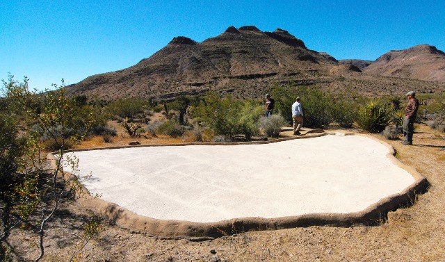
Clear water gushes from a hole in the ground, forming Bonanza Spring, the largest spring in the southeastern Mojave Desert.

This rare oasis is at the center of the fight over a company’s plan to pump groundwater and sell it to California cities.

Cadiz Inc. is proposing to pump an average of 16.3 billion gallons of water each year for 50 years. The company says the project won’t harm any of the springs in the area, and it recently presented a study in which researchers concluded Bonanza Spring wouldn’t be affected by its groundwater pumping.

Now other researchers have come to the opposite conclusion, saying in a new study that Bonanza Spring is likely connected to the same aquifer where the company plans to draw water from wells, and that the project would put the spring at risk of drying up.

Andy Zdon, a hydrogeologist who led the study, analyzed water samples from the spring and determined that unlike other nearby springs, which are fed by rainfall that collects in relatively shallow underground sources, Bonanza Spring flows with water that comes from much deeper underground.

Zdon said the research points to a “hydraulic connection” between the spring and the aquifer that Cadiz intends to use, indicating the spring would probably be affected by the decline in the water table.

“The spring is going to be highly susceptible to drawdown from the pumping,” Zdon said. “It would likely dry up.”

The study, which was published Friday in the journal Environmental Forensics, involved a chemical analysis of water from Bonanza Spring and other springs in Mojave Trails National Monument. The research was conducted by consulting firm Partner Engineering and Science Inc. and funded by the Mojave Desert Land Trust, a nonprofit conservation group that opposes the Cadiz project.

Zdon and his team analyzed the oxygen and hydrogen isotopes in the water and said the water in Bonanza Spring has different characteristics than several other springs in this part of the desert. The stable isotopes in rainwater vary with latitude and elevation, and Zdon and his colleagues used those “signatures” to examine the sources of the spring water.

They determined that Hummingbird, Teresa, and Chuckwalla Springs are “perched” springs, which are relatively shallow and fed by local rainfall percolating into the ground, but that the water in Bonanza Spring differs from local rainfall and instead matches rain that falls well north of the Clipper Mountains in other mountains in the Mojave National Preserve.

The scientists also found that unlike other springs, the water in Bonanza Spring has similar characteristics to groundwater in the aquifer in the adjacent Fenner Valley — including the Fenner Gap, an area where Cadiz plans to pump groundwater.

Zdon coauthored the research with hydrogeologists M. Lee Davisson and Adam H. Love. They said in the study that Bonanza Spring “has generally been assumed to be a perched spring disconnected from the basin-fill aquifer system,” but that their results indicate it’s likely connected with that larger reserve of groundwater.

And if groundwater levels decline due to pumping, the researchers wrote, that “could result in an uncertain, but potentially substantial decrease in free-flowing water from the spring.”

Cadiz disputed the findings, and scientists who recently studied the spring for the company called the new research flawed.

“Zdon does not account for the existence of two observable geologic faults that fully insulate the Bonanza Spring from any impact from the Cadiz Water Project,” Cadiz President and CEO Scott Slater said in a statement.

In the earlier study commissioned by the Los Angeles-based company, researchers identified two faults that they said block groundwater flowing in fractured bedrock. They said those two “bounding faults” intersect at the spring, and groundwater spills over the faults to form the spring.

The study, which was released in January, was conducted by geologist Miles Kenney and hydrogeologist Terry Foreman, who said the effects of groundwater drawdown around the company’s wells wouldn’t reach the area of the spring due to a “hydraulic disconnect” and faults between the two areas.

The wellfield where the company intends to pump groundwater is located about 1,000 feet lower in elevation than the spring, and about 11 miles away.

In their assessment, Kenney and Foreman wrote that “the spring’s discharge is localized within a fractured rock system that is hydraulically separated from the alluvial regional groundwater system in Fenner Valley located three miles to the east.” They said their research “demonstrates that the perennial spring discharge is controlled by the existence of two bounding faults.”

As part of the research, Kenney mapped the faults and the geology around the spring. During six days of field work, Kenney inspected a tunnel uphill from the spring on the mountainside that was apparently excavated in the early 1900s by miners, and he found a portion of the fault exposed in the wall of the passage. The other intersecting fault zone was also visible.

“Essentially those faults act like dams,” Foreman said. “It’s effectively a subsurface dam that then causes the water to overspill, groundwater to spill over those faults.”

The researchers who prepared the study for Cadiz said the spring’s flow depends on recharge from precipitation in a catchment area that extends over four miles to the north.

“The spring is going to be controlled absolutely by climatic conditions, basically changes in long-term rainfall and recharge above where those faults occur,” Foreman said. “It’s going to be driven by that recharge as opposed to anything that happens in the valley.”

Kenney criticized Zdon’s research, saying “he basically didn’t look at the local geology.”

“We think it’s flawed and it needs to be corrected,” Foreman added.

Arguing over the science

Zdon said he disagreed with the conclusions of the study commissioned by Cadiz. He pointed out that Kenney and Foreman didn’t include a similar analysis of water samples.

“You can’t begin to source where water comes from without looking at the water itself, and they did not do that,” Zdon said.

Zdon previously conducted a survey of more than 300 springs and water holes across the Mojave Desert for the federal Bureau of Land Management during 2015 and 2016. He’s found that most of the springs in the desert rely on local precipitation and may increase or decrease in flow depending on whether it’s been wet or dry.

But Zdon said records from more than a century ago show that Bonanza Spring is different and that its flow has held steady at about 10 gallons a minute. It’s still putting out as much water as it did in the early 1900s, he said, when a pipeline carried water downhill to the railway stop in Danby to fill tanks aboard passing steam engines.

Zdon said other measurements provided additional clues. When a spring depends on shallow groundwater, the water temperature is usually close to the average annual air temperature. But the water in Bonanza Spring emerges from the ground more than 11 degrees warmer, indicating it’s warmed up by the earth deep underground. His team calculated the water must be coming up from more than 750 feet underground.

Zdon also analyzed the water to check for tritium, a radioactive isotope of hydrogen that was released into the atmosphere with nuclear weapons testing starting in the late 1940s. The water in nearby Teresa Spring contains tritium, showing the water fell as rain or snow sometime between the 40s and the present day. But the water in Bonanza Spring contains no tritium, indicating it’s been underground since before those atomic tests.

Zdon said other carbon-dating tests, which weren’t described in their study, have found that the water coming out of Bonanza Spring has been underground for approximately 15,000 years.

“So, between the groundwater ages, the temperatures and the chemistry, looking at it from three different directions, it’s all pointing to the same answer: that this is tied into more regional flow,” Zdon said. “That water has got to be moving towards the Clipper Mountains through the basin-fill aquifer… and seeping through the Clipper Mountains, probably along fractured rocks along the fault zones, and surfacing at the spring.”

On that point, too, the scientists who prepared the report for Cadiz said they disagree based on their observations and their work mapping the faults and reviewing scientific papers. They also studied documents concerning two old mines located about a mile northeast of the spring.

The groundwater levels in those inactive mines are about 150 feet lower than the elevation where water flows from Bonanza Spring, they wrote, suggesting that the faults in the area, which run from the northwest toward the southeast, act as barriers and “groundwater flow is effectively compartmentalized.”

“It’s physically impossible for groundwater to move from the north, across that area where those mines are, to Bonanza Spring,” Foreman said. “Groundwater levels to the north of Bonanza Spring are lower, so there’s no way that groundwater levels can go from a high to a low and then essentially go back uphill. It’s just physically not possible.”

Kenney also reviewed aerial images in mapping the faults and the geology. Cadiz’s research team said they found other geologic signs including an abundance of precipitated minerals along the fault zones, “indicating that the faults can be strong groundwater barriers.”

As part of the study commissioned by Cadiz, 10 hydrologists and geologists visited the spring in December with Foreman and Kenney, and five of them reviewed the report and agreed with the conclusion that the spring wouldn’t be affected by the water project.

Cadiz has proposed to pump groundwater on land surrounded by Mojave Trails National Monument. The company owns 34,000 acres in the desert along Route 66, and it plans to build a 43-mile pipeline to carry water from its property to the Colorado River Aqueduct.

In 2011 and 2012, Cadiz’s proposal went through an environmental review under the California Environmental Quality Act. Orange County’s Santa Margarita Water District served as the lead agency in the review process and certified the environmental impact report. The document repeatedly states that “the physical evidence indicates” the aquifer isn’t connected to the springs and therefore the pumping would have no impact on the springs.

Conservation groups challenged the environmental review in court, but they lost.

Frazier Haney, land conservation director for the Mojave Desert Land Trust, said the new research shows those environmental review documents were based on incomplete science and that the water project poses a serious threat to the spring.

During a visit to Bonanza Spring, Haney walked past blooming brittlebush shrubs and wildflowers to the edge of the spring, where the thick vegetation rustled in the breeze. He said he’s seen mountain lion tracks here. The spring is also frequented by bighorn sheep and bobcats that come to drink, and by migratory birds that forage among the trees.

Frogs and tadpoles swim in the ponds, and dozens of species of native plants grow in the wetland, which stretches a half-mile downhill from the spot where water pours out of the ground.

Walking to the top of a bluff, Haney looked out over the springs.

“It’s a magical place,” Haney said. “Springs like this are one of the most important parts of the ecosystem.”

From the ridges above the spring, you can see the open desert of the Fenner Valley below. It stretches out in a plain between mountain ranges, covered with creosote bushes. Haney pointed out the patch of the desert where Cadiz is proposing to drill new wells.

“Intensive groundwater pumping out here could be devastating for the ecosystem,” Haney said.

His group focuses on buying lands to protect parts of the desert for conservation. It has purchased more than 71,000 acres for conservation since 2006. Some of those lands have been transferred to the federal government and have become part of the Mojave Trails National Monument.

Cadiz’s managers have said they plan to use groundwater that would otherwise gradually flow downhill and evaporate from two dry lakes. On those dry lakebeds, other companies dig trenches in the cracked soil to extract salts left by the evaporating water.

The concept of using water that would otherwise evaporate from the lakebeds is reflected in the company’s formal name for its plan: the Cadiz Valley Water Conservation, Recovery and Storage Project.

“The Cadiz Water Project will stop the annual loss of more than 10 billion gallons per year to evaporation,” Courtney Degener, a vice president and spokesperson for the company, said in an email. “It cannot and will not impact area springs but it will make available new water for 400,000 people, create critical groundwater storage capacity for our region and support 5,900 new jobs in a safe and sustainable way.”

Degener said Zdon’s new study “fails to account for the most current field work and hydrogeological conclusions about area springs, and does not present any new credible findings.”

‘Cone of depression’

Cadiz’s proposal has been hotly debated for years. While pursuing the plan to sell water, the company has been pumping groundwater on its property to irrigate nearly 2,000 acres of farmland, growing lemons, grapes, raisins and other crops.

During President Barack Obama’s administration, federal officials had hindered the project by ruling that the company would need a new permit to build a water pipeline alongside a railroad.

But in October, President Donald Trump’s administration reversed that decision and gave the company a green light. The federal Bureau of Land Management told Cadiz it wouldn’t need a permit to build the pipeline along the railroad right-of-way.

Two environmental groups — the Center for Biological Diversity and the Center for Food Safety — are challenging that decision in a lawsuit. Another group, the National Parks Conservation Association, is suing to challenge a related policy change: a 2017 Interior Department legal opinion that said railroad companies are allowed to lease out portions of their rights-of-way for other purposes without going through a federal environmental review.

Cadiz has said it plans to move ahead with designing and building the water pipeline alongside the railroad.

That plan still could face obstacles, though, because some of the land where Cadiz wants to build the pipeline is owned by the state. And in September, California’s State Lands Commission told the company that any use of the state-owned lands under its jurisdiction would require a lease and its approval.

Opponents of the project seized on the new study, saying it reveals problems in the 2012 environmental review.

“Given this new information, I strongly believe Cadiz’s CEQA review must be reexamined,” Sen. Dianne Feinstein said in a statement Friday. “Cadiz needs to accept this new scientific study and abandon its goal of draining the Mojave Desert of its most precious resource: water. It’s time Cadiz and its investors give up on this desert boondoggle.”

Chris Clarke, California desert program manager for the National Parks Conservation Association, agreed and said the new research “demonstrates Cadiz has used a flawed hydrology model that produced flawed analysis” for the environmental review. He said that process “now must be corrected through additional environmental review.”

The company’s officials have defended the environmental review, pointing out that California’s environmental law is considered more stringent than any federal environmental law and that San Bernardino County in 2012 approved a groundwater management plan — formally titled the Groundwater Management, Monitoring and Mitigation Plan — which sets additional limits for the project.

Cadiz also points to the court decisions upholding the review.

“Peer-reviewed science, physical observations of the region and California’s courts all agree: The Cadiz Water Project will protect the desert environment including Bonanza Spring,” Degener said.

The groundwater management plan details the county’s oversight role for the project.

“It is not anticipated that the Project will have any impact on the springs,” the document says. “Nonetheless, this Management Plan provides for quarterly monitoring of the Bonanza Spring as an ‘indicator spring’ because it is the spring that is in closest proximity to the Project wellfield.”

The plan calls for “baseline and periodic visual observation and flow estimates” and says monitoring wells between the wellfield and the spring would be used to track groundwater levels.

According to the plan, if there’s a reduction in the spring’s flow and it’s determined to be due to the company’s wells, “corrective measures” would include reducing pumping, changing pumping locations in the wellfield or stopping groundwater extraction.

More: Federal policy change criticized for giving ‘free pass’ to controversial desert water project

One of the concerns that Zdon and others raise about Cadiz’s plan is that the pumping would create a “cone of depression” in the aquifer as groundwater flows from surrounding areas toward the company’s wellfield.

The way groundwater drawdown occurs in the desert, Zdon said, “it’s very hard to control what happens once that cone of depression starts building.”

Once the pumping begins to lower the water table, that depressed area of the aquifer would continue to expand for years, even if the pumping were stopped.

Given that dynamic, Zdon said, the monitoring plan “is not sufficient to be protective of the spring.”

“When you lower the water table below a spring system like that, the first thing you would notice is a reduction in surface flow and maybe a complete cessation of any kind of surface water at the site,” Zdon said. “If you see an impact at the spring, it’s probably too late.”

Cadiz’s executives and researchers responded that the sort of monitoring Zdon is calling for is already part of the county’s plan.

Degener said the project “will be regulated by an extensive groundwater monitoring plan enforced by the County that includes the exact kind of groundwater monitoring Zdon recommends and goes even further including monitoring features across the entire watershed.”

There are already two existing monitoring wells, one uphill from Fenner Valley and another close to Danby, Foreman said.

“It’s interesting that the water temperature in those wells is actually higher than the water temperature of the spring,” Foreman said. “And so that water has obviously moved over long distances and it’s 2 to 3 degrees higher in temperature than the spring, so we think that the spring is more local water, and those water temperatures show that separation.”

Kenney and Foreman said some of Zdon’s findings are consistent with their own but they disagree with the conclusions, including that the spring would be fed by recharge from an area far to the north.

“I’m wondering how much of his findings might change if he was to consider the watershed that we considered, not north of the Clippers but just simply the rocks in the western Clipper Mountains,” Kenney said.

Zdon and his colleagues stressed that if the pumping begins, more intensive monitoring would be necessary to protect the spring. They wrote that the groundwater monitoring “should be designed to obtain sufficient early warning of potentially damaging groundwater level decline.”

They said relying on observable changes at the spring would be ineffective, and that drilling monitoring wells close to Bonanza Spring would provide a way of spotting a decline quickly — before it’s too late for the spring.

Their research included not only data collected by Zdon and his colleagues, but also data from a study that researchers from the Lawrence Livermore National Laboratory conducted in 2000 for Cadiz and the Metropolitan Water District, which were working together at the time on an earlier iteration of the project.

That earlier research focused on identifying the recharge area and estimating the amount of recharge. It included geochemical analyses of the water in Bonanza Spring and other springs and wells.

Davisson, who was one of Zdon’s coauthors, also helped carry out that research for Lawrence Livermore back in 2000, and the data was publicly released in August 2017.

Zdon said the data helped confirm his team’s findings.

“We were actually largely using the same analytical techniques in sampling that Lawrence Livermore used back in 2000 on behalf of Cadiz,” Zdon said. “What that did was essentially confirm our sampling, because basically our results 17 years later were nearly identical with what Lawrence Livermore came up with.”

April 13, 2018

Pahrump-based radio host Art Bell dies at 72

Radio host Art Bell dies at 72

Las Vegas Review-Journal

Longtime radio host Art Bell died Friday at his Pahrump home, the Nye County Sheriff’s Office announced. He was 72.

Bell’s paranormal-themed show, “Coast to Coast AM,” was syndicated on about 500 North American stations in the 1990s before he left the nightly show in 2002. He broadcast the show from Pahrump’s KNYE 95.1 FM, a station he founded.

Bell retired several times in his career, which included a short-lived show on SiriusXM satellite radio in 2013.

Returning to terrestrial radio afterward was not a difficult decision, he told the Pahrump Valley Times in August 2013.

“That’s easy, because I love it,” he said at the time. “It’s my life, and that’s all I have ever done. I went through a lot of family problems, so that interrupted things, and I was overseas for four years, and that certainly interrupted things. I went back into radio because I love it.”

Bell was inducted into the Nevada Broadcasters Association Hall of Fame in 2006. He did not attend the presentation.

In 2008, Bell was inducted into the National Radio Hall of Fame.

Bell was born in Jacksonville, North Carolina, on June 17, 1945. He served in the the U.S. Air Force as a medic during the Vietnam War.

According to the Coast to Coast AM website, Bell was an FCC licensed radio technician at age 13. He also set a Guinness World Record for a solo broadcast marathon, at more than 116 hours, while working as a DJ in Okinawa, Japan, the website said.

April 10, 2018

Finding beauty in detritus in the Mojave Desert

Noah Purifoy’s Outdoor Museum of Assemblage Sculpture in Joshua Tree. “No Contest (Bicycles)” (Helen Gordon/CC BY 2.0)

Mike McPhate
The California Sun


In the Mojave Desert, a post-apocalyptic menagerie of 100 or so sculptures rises from the dust.

Visitors, often arriving from long distances, wander among the large works built from junk: toilets, television sets, tires, broken keyboards, and other found objects.

There is a snake-like installation made from lunch trays, walk-through structures filled with castoff clothing, VCRs, bottles, and folded newspapers, and bowling balls fashioned into a gigantic Newton’s cradle.

This is Noah Purifoy’s Outdoor Museum of Assemblage Sculpture, the life’s work of one of California’s most fascinating artists.

Purifoy was born in rural Alabama in 1917. He fought in World War II, then emerged later as an influential assemblage artist in 1960s Los Angeles, where he created sculptures from the rubble of the Watts riots and led the Watts Towers Art Center.

In 1989, he fled to Joshua Tree. “I wanted to do an earth piece,” he once explained to a journalist, “and you can’t get that much land in Los Angeles to do an earth piece.”

For the next 15 years, Purifoy constructed his magnum opus on a 10-acre lot at the end of a dirt road. The high-desert setting — silent, vast, and severe — seemed to heighten the strangeness of the works.

Purifoy died in 2004 at the age of 86. The Noah Purifoy Foundation was created to look after the open-air museum, a mission that has been tempered by the artist’s stated belief that the desert itself was his collaborator.

“I do assemblage. I don’t do maintenance,” Purifoy told the L.A. Times. “What nature does is part of the creative process.”

Still, the foundation has worked to prolong the life of the sculptures — touching up paint and adding guy wire to make sure things don’t fall — while acknowledging that some of it will be lost to the elements.

“Obviously there’s diminishing returns on a lot of the work,” said Joseph Lewis, the foundation’s president. “But some of it will stand the test of time.”

Lewis said Purifoy’s legacy, beyond his desert shrine, is in the inspiration the African-American artist spread throughout the art world — highlighted in a major retrospective at Los Angeles County Museum of Art in 2015 — especially within the black community.

“His conceptual footprint is very, very large,” Lewis said, “and we want to make sure that that is put into the history books and into the canon.”

March 29, 2018

Forget Punxsutawney Phil: Vegas has own forecaster

It isn’t springtime here till this desert tortoise leaves his burrow

MOJAVE MAX has been announcing the end of winter in Las Vegas since 2000, but his public relations team is still working on raising his profile. This year he emerged on March 23 to declare the arrival of springtime. (Springs Preserve)

David Montero
Los Angeles Times


Mojave Max, the desert tortoise in Las Vegas who marks the arrival of spring each year when he emerges from his burrow, has always existed in the long shadow of Punxsutawney Phil — the ultimate case of a big star in a small market.

It's Phil who nabs the national headlines and knowing nods from high-profile news anchors when he is yanked out on Feb. 2 to let the nation know how much longer winter will last.

The groundhog from Pennsylvania has always hogged the limelight when it comes to weather prognostication — a Goliath among all creatures great and small. Even this story, which is about Mojave Max, starts off about Phil. See how it is?

The rodent's public relations team wasn't overly impressed when it heard Mojave Max had emerged from his burrow last Friday to declare the start of spring in Las Vegas.

"Ever heard of Mojave Max?" I asked Katie Donald, the executive director of the Groundhog Club in Punxsutawney.

"I'm sorry, I haven't," Donald said.

"Are you aware of other animals that do, um, seasonal work?" I asked.

"We're aware of few," Donald said. "There's a lobster in Maine — I can't think of his name. And there's a few imitator groundhogs in the Pennsylvania area that we don't acknowledge."

(The lobster is Passy Pete, by the way, and he predicts if summer will last another six weeks by opening a scroll with a claw. Forecast: It might be boiling hot, Pete. Beware.)

But Pete is in Maine, a far-flung state that is famous mostly for Stephen King, lighthouses and lobster rolls. There's also Mojave Maxine, a desert tortoise at the Living Desert in Palm Desert. She emerged from her burrow Jan. 31.

So, how is it that Mojave Max — a desert tortoise in a city that is internationally iconic and draws the biggest stars to its 24-hour spotlight — isn't much known beyond the Clark County line?

"We're working on that," concedes Dawn Barraclough, a spokeswoman for Springs Preserve, where Mojave Max lives.

Around 1994, as part of the Desert Conservation Program's effort to bring attention to the desert tortoise's threatened species status, one was identified in the area and moved to the Red Rock Canyon visitor center. He was named Mojave Max.

The resident desert tortoise, about the size of a football, has been identifying seasonal changes publicly since 2000. when the first Mojave Max emergence contest was held. When Max emerged from his burrow, the biologists would note that it signaled the start of spring in the area.

It was more low key back then — especially by Vegas standards — as the Las Vegas Strip was on the cusp of going big with resorts like Bellagio that brought in rare white tigers and dancing fountains. If Punxsutawney Phil were ever to move to Vegas, he'd probably have his own residency at a casino.

Max, seemingly, would prefer his residency to remain a dirt hole.

Heather Green, a spokeswoman for the county who works for the Desert Conservation Program, said the earliest that Mojave Max has emerged from his burrow in his years as a seasonal forecaster is Feb. 14. The latest is April 17.

Last year, biologists decided it was better for Max to not be bothered at Red Rock Canyon anymore, and he retired to a quieter life. But the tradition still carried on with a new Mojave Max — a 14-year-old desert tortoise living in captivity at Springs Preserve. In showbiz parlance, a casting change. Roger Moore in for Sean Connery. (In James Bond fashion, Max currently lives with four female tortoises on 15 acres of open space at Springs Preserve.)

Max's profile has also been raised on social media, where the tortoise has a Twitter account.

"Yep! It seemed like a good day to EMERGE!! My official emergence date and time: March 23, 2018 at 11:11 am! SPRING HAS SPRUNG," the tweet from @MojaveMax read.

Green said that, unlike Punxsutawney Phil, Max is allowed to dictate the seasonal change rather than being yanked out of a hut on a predetermined day, the way Phil has been marking Groundhog Day for more than 130 years.

Donald said Phil's track record is unblemished.

"He's been right 100% of the time," she said.

Time magazine did an analysis of Phil's accuracy and it revealed he was actually correct only about 36% of the time. This year, a warrant was issued for Phil's arrest by the Monroe County Sheriff's Office in Pennsylvania for deception — claiming that winter has continued longer than the six additional weeks predicted by the groundhog. Phil's publicity team argued that the warrant was a misguided attempt to blame the messenger rather than Mother Nature.

It should be noted that Mojave Max has never been subject to an arrest warrant.

Phil's club also steadfastly sticks to the lore centered around the groundhog's age. Donald said that because of a special elixir administered every few years, the same Phil has been doing prognostications for the past 132 years. Donald will not budge on this point, even though a groundhog's lifespan typically doesn't exceed eight years.

Green said desert tortoises live between 50 and 80 years. And Max doesn't have to drink an elixir, either. Just water.

But with a long lifespan, Mojave Max could have this gig for quite a while. A Vegas residency with the staying power of a Wayne Newton, Liberace or Celine Dion.

March 25, 2018

Mojave National Preserve releases plan to remove most man-made wildlife water

Most small game guzzlers like this one would be removed or neglected into a non-functioning condition under the new NPS policy.

By JIM MATTHEWS
www.OutdoorNewsService.com


This has happened before.

The Mojave National Preserve released its Management Plan for Developed Water Sources on Tuesday this past week along with the environmental assessment of the plan’s impacts, effectively laying the groundwork for the abandonment or removal of well over 100 historic man-made water sources and developed springs used by wildlife.

Wildlife enthusiasts have been down this road before on the Preserve, when its second superintendent, Mary Martin, directed the removal and destruction of historic cattle water sources that had served wildlife for over 75 years. This was a direct violation of the Preserve’s own management plan that called for the evaluation of the impacts that water removal would have before they were removed. That evaluation never happened, but over 100 water sources that benefitted wildlife were removed that time around.

Now, this week’s document lists four alternatives for action within the plan, but all four would lead to the loss of all but two or three of the developed water sources within designated wilderness areas. It would also lead to the loss of dozens of water sources outside of wilderness.

The impacts on wildlife this would cause within the Preserve are dismissed and not addressed in any detail in the plan, calling the impacts “localized and small,” without any supporting documentation.

The public has a 30-day window (until April 19) to comment on the plan. More information and copies of the plan are available on the Preserve website at this direct address: http://parkplanning.nps.gov/moja_waterplan_ea.

Behind the scenes, the Department of Fish and Wildlife field staff is seething over the NPS’ plan. These are the scientists who are watching decades of their water development work and resulting successes wildlife protection and mitigation for natural water source losses across the desert.

The official DFW statement from Jordan Traverso, Sacramento-based information chief, hinted at the outrage, but was restrained.

“Natural and reliable surface water sources are not always available in the current desert environment,” she said Saturday. “The Department has worked with many partners over the years, including the NPS, to establish and document the importance of reliable water sources for wildlife. Across the California desert and since the early 1950s, wildlife water developments have provided this basic necessity to support and stabilize desert wildlife populations.

“While wilderness protection would guide land managers toward keeping a natural and undeveloped landscape, the wildlife that live in these landscapes deal with the reality of the anthropogenic changes imposed upon them. Though they offer protection, large and wild spaces alone do not necessarily ensure that a viable wildlife population can be maintained in perpetuity given some of those changes on the landscape.

“As wildlife managers, we look forward to collaborating with land managing agencies to ensure that wildlife and the habitat needs they require are secured when making changes to available resources within the landscape.”

Hunting conservation groups feel betrayed. Their decades-long conservation efforts to restore and update these man-made guzzlers, spring developments, and the conversion of cattle water to wildlife water on the Preserve are set to be abandoned or destroyed.

In a nutshell, the plan is an assault on all wildlife within the preserve and spells out the agency’s vision of “wilderness.” That vision comes at the expense of all desert wildlife and virtually all the other mandates called for in the Preserve’s management plan. Those who have battled through the 233 pages of “bias and hypocrisy” have pointed out major flaws common to all alternatives.

Cliff McDonald, the president of Water for Wildlife, a conservation group that has repaired over 160 guzzlers in the past several years, including many on the Preserve before the work was halted there, was outraged by the lack of common sense in the NPS proposal.

McDonald pointed out that the 68 big and small game guzzlers within wilderness occupy less than 3/4s of an acre total ground space of the 804,000 acres of wilderness within the Preserve, but the Preserve staff believes that 3/4 acre impacts “wilderness character” to the detriment of the designation.

“The impact is on one one-millionth of the Preserve’s wilderness. One millionth! How is that impact of the wildness an issue?” asked McDonald. “Don’t the benefits of this water for desert wildlife outweigh the impacts?”

Ironically, even the current Preserve superintendent Todd Suess has admitted to DFW staff that the Wilderness Act doesn’t mandate the removal or abandonment of these historic structures to comply with the wilderness designation. In fact, on nearby Bureau of Land Management Lands, also designated wilderness, maintenance and even construction of new guzzlers has been allowed because of the value to wildlife.

According to opponents of the water plan, the hypocrisy comes in when you realize the plan’s alternatives continue to allow at least two big game drinkers within the preserve’s wilderness because of their documented importance to bighorn sheep, but somehow decided the other wildlife drinkers have no importance.

Yet, the National Park Service has done no assessment to evaluate the impact the removal of the other 66 man-made drinkers will have on all wildlife that currently use those water sources. It has been determined -- apparently by “fiat and lots of hypocrisy” -- that quasi-pristine wilderness is more important than wildlife. Ironically, most of the guzzlers would not be removed or their footprint restored, they would simply remain and allowed to decay until non-functional. So, theoretically, the negative impacts will still exist -- they just won’t serve an important wildlife function any longer. This is simply insane.

The NPS staff is also mandated to protect and maintain historic sites throughout the Preserve, and most of these guzzlers were made in the 50s, as part of a concerted effort by the state DFW to create and enhance water sources for wildlife, even then recognizing the important to mitigate for urban sprawl and loss of historic natural water sources. There has been no effort by Preserve staff to recognize the historic value of these guzzlers or to maintain them for their intended purpose.

The park service has even been obstructing the gathering of data that would show the importance of water for the Preserve’s wildlife. Eight years into a comprehensive deer study on the Preserve, the park service removed its support of the project when it was entering a phase when the importance of man-made water sources would be evaluated and tested by turning on and off some of these sources and measuring impacts. The reason support was removed: It wasn’t going to affect the park service’s decision on how to manage the water sources.

The document also says there are 311 natural springs on the Preserve. Somehow that number has increased in this period of drought from a list of 101 that were found to hold year-around water in the 2008 NPS survey of springs. Many of the 175 suspected springs checked during those surveys proved to be dry or seasonal water sources.

So, how has the number of springs increased?

Is that a fabrication that includes historic (now dry) springs, seasonal seeps, and tenejas? Who knows? Is the number included to make the Preserve seem awash in natural water?

It’s not. It’s a desert and barren of wildlife where there is not available water. Sadly, that includes most of the Preserve’s lands. Where there’s water, the Preserve is a wildlife oasis.

So what is this water removal plan really all about?

That is the mammoth in the creosote that no one is talking about:

Fundamentally, it is about the bias the NPS staff has against the Preserve’s number one visitor: Hunters. Hunters still make up the bulk of the visitation on the Preserve. Hunters are the only volunteers trying to maintain this desert wildlife water since that job was abandoned by the state Department of Fish and Wildlife and never even attempted by the federal land management agencies, like the NPS.

Hunters (and cattle ranchers) are the only reason there is the diversity and quantity of wildlife there is on the Preserve. Over 350 species of birds and mammals have been documented on the man-made water. (So, no, it’s not only about the seven species of wildlife that may be hunted in the desert.) Preserving and adding water in desert is a good thing for all wildlife, and it is a means of mitigating for what has been lost through human activity elsewhere in the Mojave.

But it still sticks in the craw of the National Park Service staff that hunting was allowed on the vast property, and they are willing to sacrifice the Preserve’s wildlife to try to reduce or eliminate the number of hunters. They are willing to abandon 75 years of solid conservation efforts to bring the deer and desert sheep herds back. They are willing to dramatically reduce the numbers and diversity of birds and small mammals for their agenda.

There is no other explanation for this insanity. They all know the Wilderness Act doesn’t mandate actions this extreme. There is simply no other explanation.

Hopefully, enough people will get their federal representatives involved. Maybe then Ryan Zinke, the Secretary of Interior, will hear about this outrageous proposal and have it quietly withdrawn because it clearly violates Interior policy about cooperation with state game agency efforts and a recent policy to enhance recreational opportunities -- like hunting -- where appropriate.

The NPS staff got away with ripping out the cattle/wildlife water and seriously impacted the Preserves wildlife populations over a decade ago. That can’t happen again.